Ganterschwil – Oberhelferschwil – Bütschwil

A lovely, low-level easy hike at the end of the Toggenburg
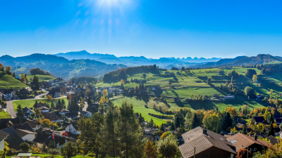
This hike is charming - along quiet lanes and through beautiful meadows. And in addition you'll have some glorious views to the Alpstein and across the Toggenberg valley.
This hike starts from Ganterschwil and ends at Bütschwil (St Gallen, north-east Switzerland).
Top tip! This hike is mostly west facing and therefore possibly best done in the afternoon or early evening.
Time of year: Spring, Summer, Autumn, Winter
Tags: Public transport, Suitable for families, Food en-route, Accommodation en-route
Rating: ![]()
Hiked by us on: 23rd October 2021
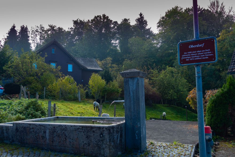
This is a gentle ridge walk through Oberhelferschwil with views in all directions and on a clear day even all the way to Alpstein and beyond. Since it is such an easy route, it can be done in any season and still offers some wonderful views. The walk starts in Ganterschwil, a village where the oldest houses date back to around 1600, and ends in Bütschwil. The 2 villages are connected by a Postbus which runs every 30 minutes.
Start the walk at the church, by the bus station and walk upwards, along a road called “in der Farb”. It will lead into a small path through the gardens. Soon you reach a road again. Turn left and make your way through the old part of the village.
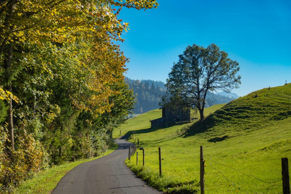
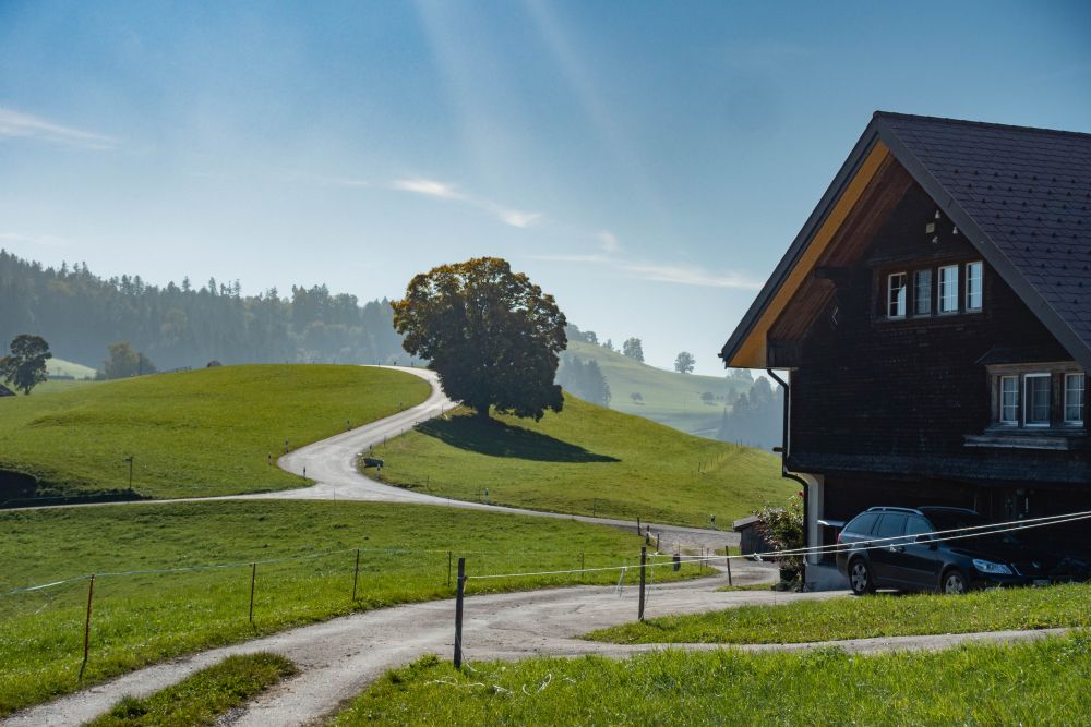
Keep walking along the quiet road, which eventually leads out of the village. You will reach a junction in the hiking path further along. Turn right, taking the road leading upwards. You are now walking steadily uphill through fields and old farm houses. The views are slowly opening up around you.
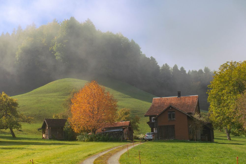
There is another junction, where you also stay right and keep walking uphill, until the path eventually levels off and you reach a set of houses called Moos. There is a lovely view of Säntis from up here.
We did this walk a couple of times and there is an old dog living at Moos who likes a bit of fuss, if you can spare a minute. Continue through the houses and about a hundred meters further, turn right onto a small walking path.
Follow the path around through the woods and fields until you reach a junction again. Now it’s straight along a road again, but the road is very quiet and the views are amazing. Follow the road past a large tree and a bench until you reach a farmhouse on the right. Turn right just before the farmhouse, following the signs to Oberhelferschwil.
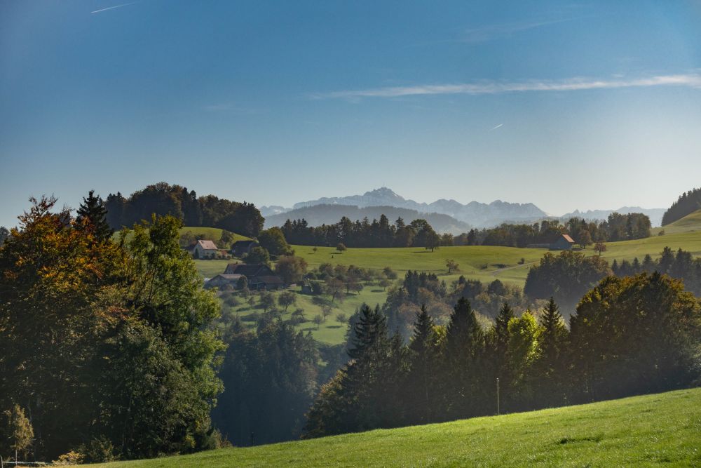
The path now meanders along the side of the hill, staying fairly level and you get some wonderful views up and down the Thur valley. At a small junction, keep left until you reach the three houses at Geissberg. Now you can chose to go up and along the top of Hinderhögg or stay right and walk along the side of it. Our hike leads to the right since the top is rather covered in woods. However, if you go over the top, you walk past the Hohe Aussicht restaurant, which has a wonderful view of the surrounding mountains.
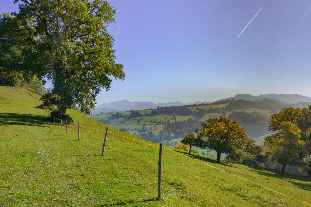
However, our hike stays right to walk along the slope of the hill, from where there are wonderful views of Säntis and the Churfirsten. Soon you will reach the village of Oberhelferschwil. Make your way down into the village and once reaching the junction at the center, turn right and soon left again to Oberwil. The path now leads evenly along the hillside, past Niederholz, until you reach Oberwil.
In Oberwil, turn right just before a farmhouse, following the signs to Wigetshof. The path along here is very quiet and meanders through fields until you reach the small village.
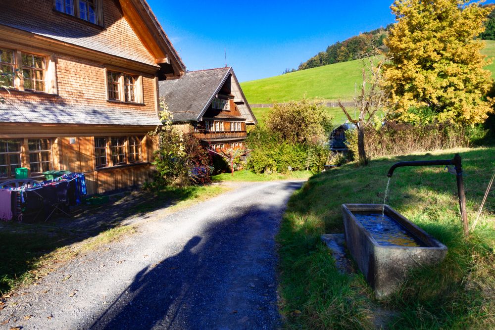
Find your way through the village by following the hiking signs to Bütschwil. There is some more downhill through fields, until you reach the woods further down. Here you have the option for a small detour to the ruins of Rüdberg, just 50m off the path, but there really is not much left of it.
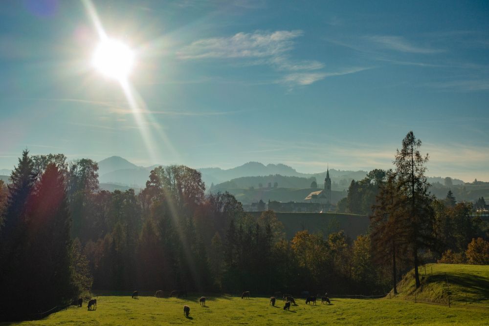
Soon after you will leave the woods again and now its an easy walk through the fields above the river Thur. Keep following the hiking signs until the path turns off to the right, where you will cross the river to reach Bütschwil.
Food, accommodation and/or villages we found on this hike
Oberhelfenschwil
(Town)
A charming village perched between Toggenberg and the Neckertal valley.
The 5 day forecast in Bütschwil
Webcams
We could not find any webcams in the area close to this hike.
Need some hiking down-time?
If you need a day off from hiking, below are some of the great things you can do within 30 km from the start of this hike.
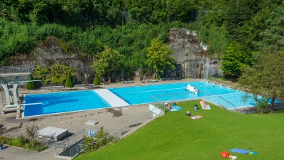
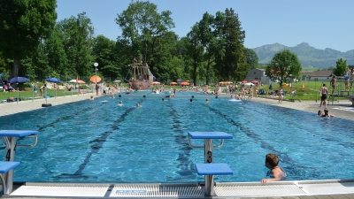
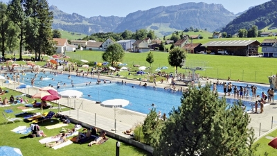
Lichtensteig outdoor pool
(6.3 km away)
Wonderful relaxing pool in the Toggenburg region
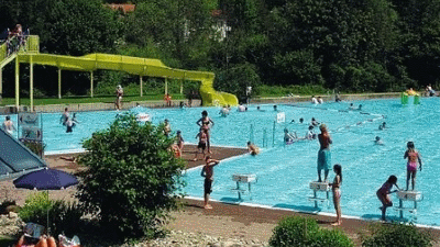
Bischofszell outdoor pool
(16.3 km away)
Relax in this lovely pool in the historic town of Bischofszell.
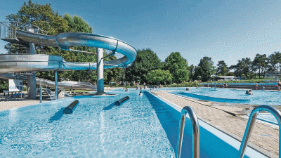
Thurfeld outdoor pool
(17.8 km away)
Lovely swimming area on the banks of the river Thur.
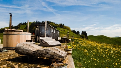
Hot-pot Appenzellerland
(18.0 km away)
Relax in a a unique hot-tub surrounded by Appenzeller hills and mountains
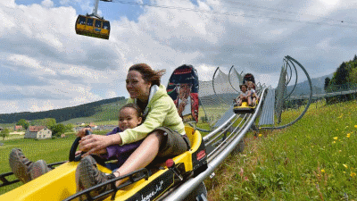
Kronberg Alpine park
(19.2 km away)
Alpine "park" with summer sledge run and rope park - fun for all!
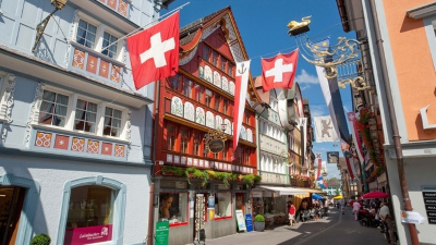
Appenzell town
(24.6 km away)
Wonderful historic picturesque town at the foot of the Alpstein mountain range
Appenzell outdoor pool
(25.4 km away)
Great outdoor pool in the shadow of the Alpstein mountain range
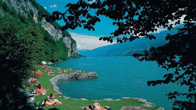
Lago Mio
(27.0 km away)
Lovely little swimming area on the banks of the Walensee close to Weesen
Gais outdoor pool
(27.1 km away)
Small quiet outdoor pool in Appenzellerland
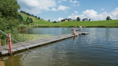
Badi Schönenbodensee, Wildhaus
(28.3 km away)
Beautiful small lake for swimming above Wildhaus below the Alpstein
Rate this hike
Have you down this hike? What did you think? Please leave us a rating!
Thanks for your rating!
Leave us a comment - thanks!
Interested in this hike?
Please feel free to contact us for more information.