Grosse Scheidegg – Wildgaerst (2891m) – Bachsee – First

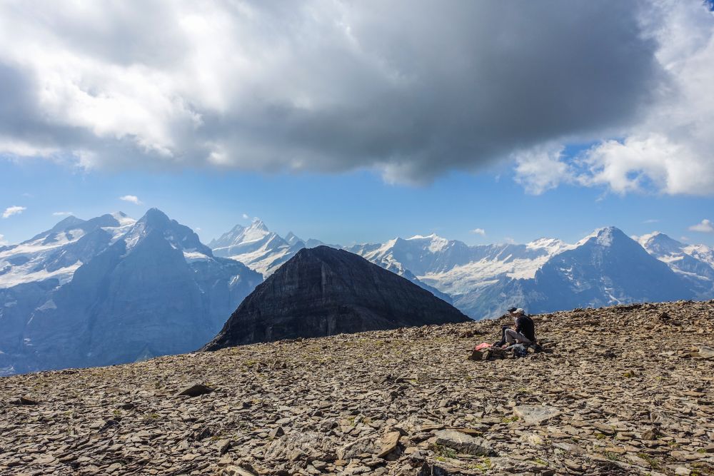
Stunning views and a 2891m peak
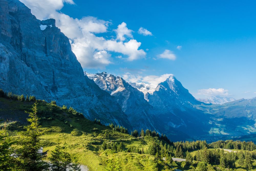
You'll have amazing views of the Eiger, Mönch and Jungfrau at the start of this hike - and then a 360 degree amazing panorama from the Wildgaerst peak. And if that's not enough, you'll end the hike with once again the incredible views of the 4000m giants around Grindelwald.
This hike starts from Grosse Scheidegg, Grindelwald and ends at Hirst gondola station (Berner Oberland, central Switzerland).
Top tip! Busses run only once per hour from Grindelwald to Grosse Scheidegg so make sure to check the departure times
Tags: Public transport, Mountain transport, Views of mountain lakes
Rating: ![]()
Hiked by us on: 31st July 2020
The area around Grindelwald is certainly popular and can be busy during the summer. If you would like to enjoy the amazing views of Eiger, Mönch and Jungfrau without the crowds, this hike up Wildgaerst may be the one for you.
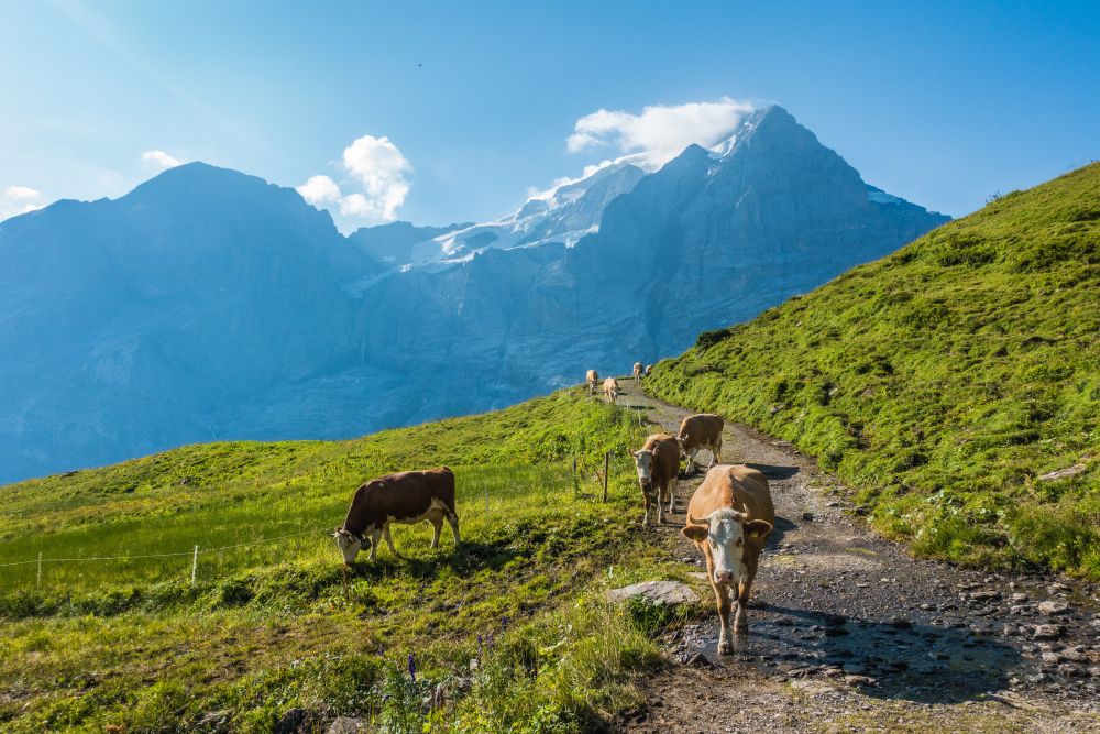
The hike starts at Grosse Scheidegg, which can be reached by Bus from Grindelwald and from Meiringen. From the pass, follow the hiking signs towards First, which lead along a ridge with amazing views on both sides.
After a bit over a kilometer, you see a path turning off to the right towards Scheidegg Oberläger. Follow that path until Oberläger, where you turn left and then left again at the next junction.
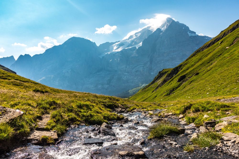
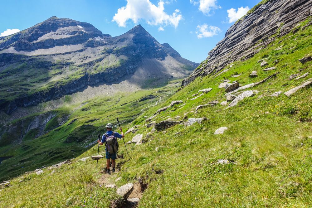
Now the path starts leading uphill along a wide valley, following a small stream. At some point the green turns into rocks and the path keeps leading uphill. Be sure to stop occasionally and look back. The views are simply stunning!
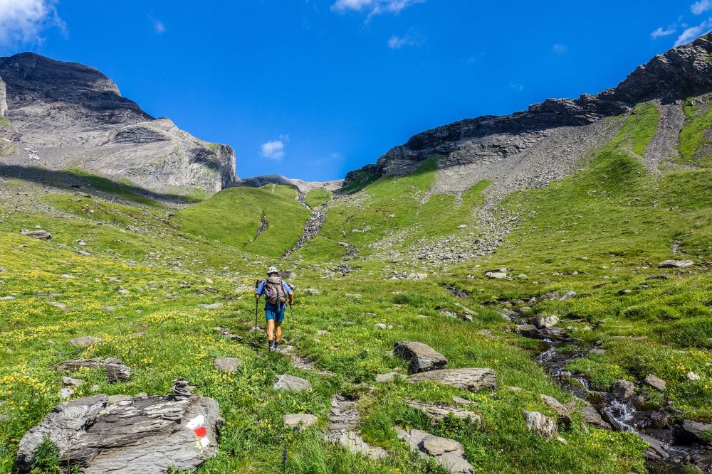
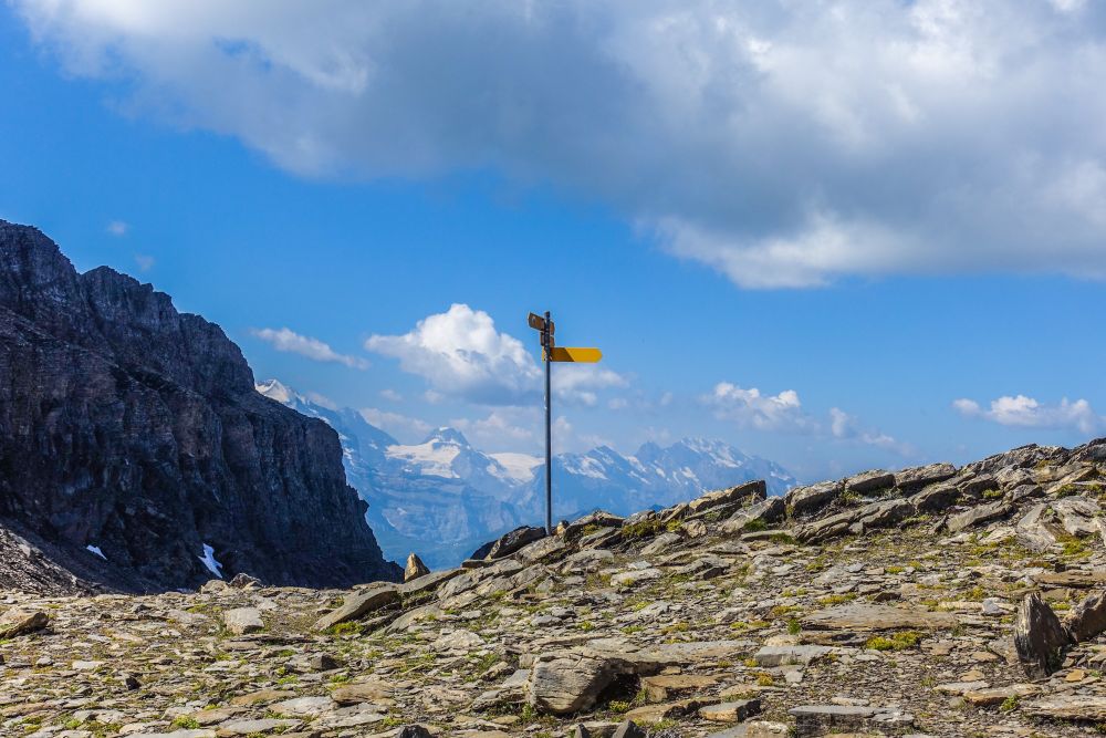
It’s about 800 Hm until you reach Wart pass. Here a path turns right to head up to the top of Wildgaerst. It’s only another 200 Hm to the top now.
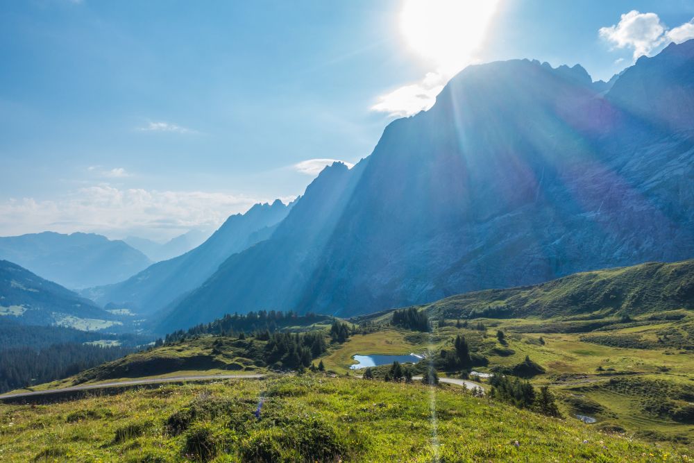
Once you have enjoyed the views from the top, make your way back down to the pass, then head right. It’s now downhill past Häxeseewli and Hagelseewli, two little mountain lakes.
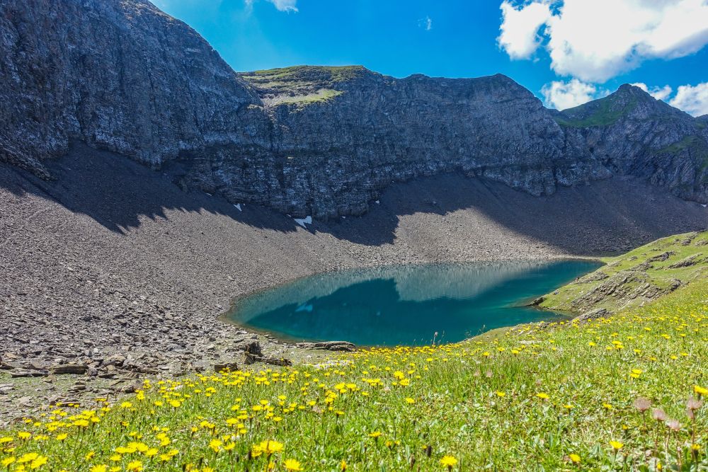
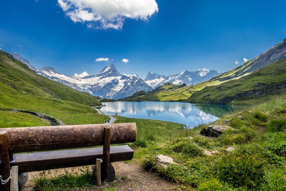
After the second lake, you could immediately turn right or continue until the next junction and then turn right. If you continue along the signs to First directly, the walk will be shorter but you will miss the amazing views of Bachalpsee lake from above.
It’s now towards Burghitta, a small wooden hut. The path turns uphill slightly but not very much. Once you meet the trail coming down from Faulhorn, turn left. There is now the view of Bachalpsee below. Amazing!
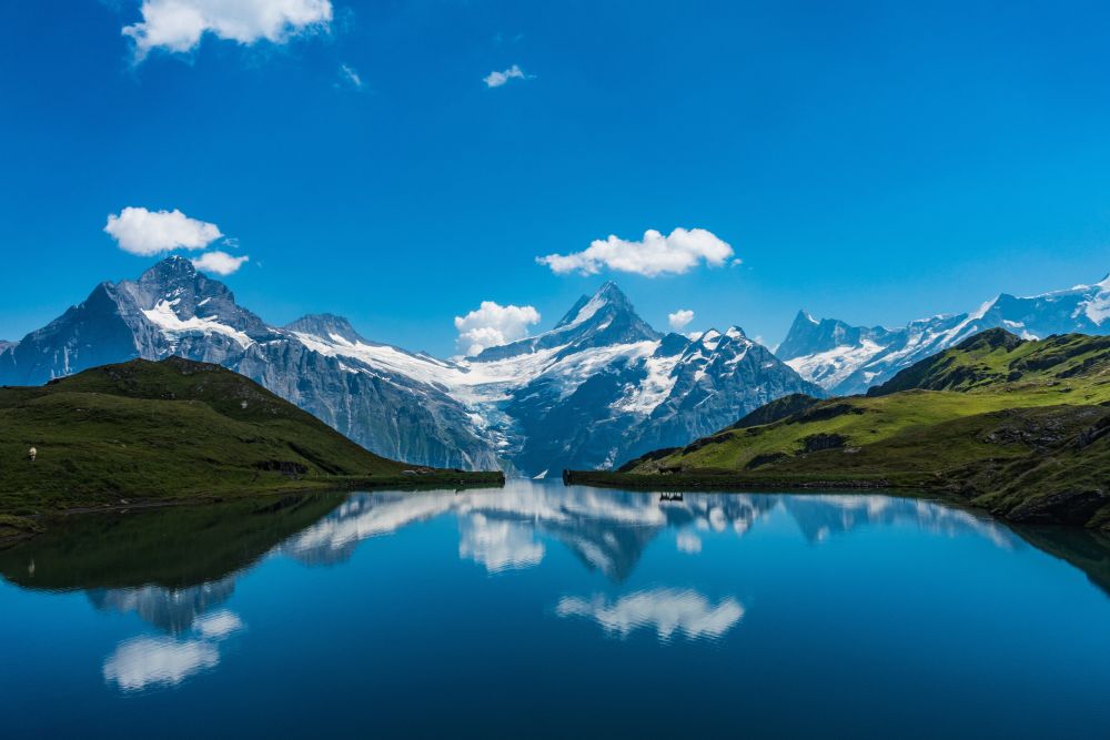
Make your way down to the lake, which might take a while because of all the photos you will want to take. The path turns left around the lake and after the lake left at a junction. From here it is only about 1.5 km to the First gondola station, from where the lift takes you back down into Grindelwald.
We did not find any places for food or accomodation on this hike. Take your own supplies!
The 5 day forecast in Grindelwald
Webcams
We could not find any webcams in the area close to this hike.
Need some hiking down-time?
If you need a day off from hiking, below are some of the great things you can do within 30 km from the start of this hike.
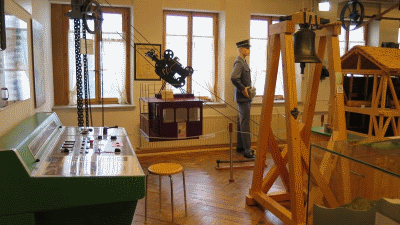
Grindelwald Museum
(5.4 km away)
Learn about the history of Grindelwald in this charming museum. Perfect for rainy days!
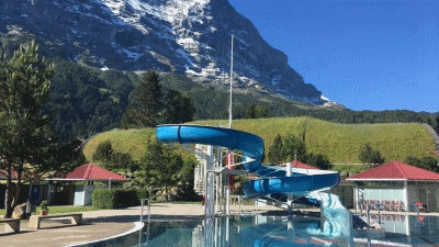
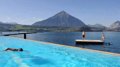
Grindelwald outdoor pool
(6.8 km away)
Glorious outdoor pool with views of the Eiger. Watch out for the chickens who patrol the grassy areas in the afternoon!
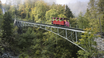
Reichenbachfall Railway
(9.0 km away)
The roaring waters of the Reichenbach Falls showed the bold engineers the way when they laid the rails for the works cable car in 1899. Eye to eye with the wild brook and the mighty, 120-meter-high Reichenbach Falls, the Nostalgiebahn with its faithfully reconstructed 24-lumber wooden car goes up in the air.
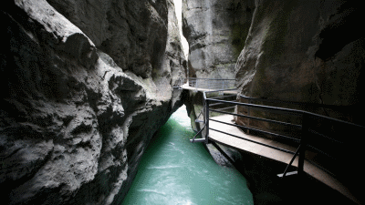
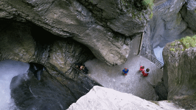
Aare Gorge
(10.8 km away)
The Haslital, one of the large valleys in the central alps, stretches from the Grimsel Pass to the Lake of Brienz. The flat valley floor of the lower Haslital is separated from the upper valley by a transverse rock formation. Over thousands of years, the Aare River eroded a path through this rock formation resulting in a gorge which is 1’400 metres long and up to 200 metres deep.
Truemmelbach Waterfalls
(17.2 km away)
With its ten glacier waterfalls inside the mountain, accessible through a tunnel lift, the Trümmelbach Falls are unique in Europe.
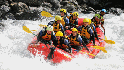
Outdoor Interlaken
(18.5 km away)
Choose from a variety of actvities including rafting, canyoning, climbing, paragliding and much much more!
Strandbad Merligen
(28.2 km away)
In many regional and national media, the Strandbad Merligen was one of the most beautiful spas in Switzerland. The fantastic view of the Niesen and the Stockhorn in the background and Lake Thun in the foreground attracts guests from near and far.
Rate this hike
Have you down this hike? What did you think? Please leave us a rating!
Thanks for your rating!
Leave us a comment - thanks!
Interested in this hike?
Please feel free to contact us for more information.