Lago Antorno – Tre Cime – Forcola de le Col de Medo – Lago Antorno

Classic, stunning hike around the Tre Cime
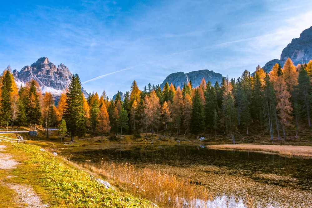
This wonderful hike goes all the way around the Tre Cime (Drei Zinnen). Best is to start from lower down at Lago Antorno allowing you to enjoy the lake and also wander through stunning larch forests enjoying even more amazing views.
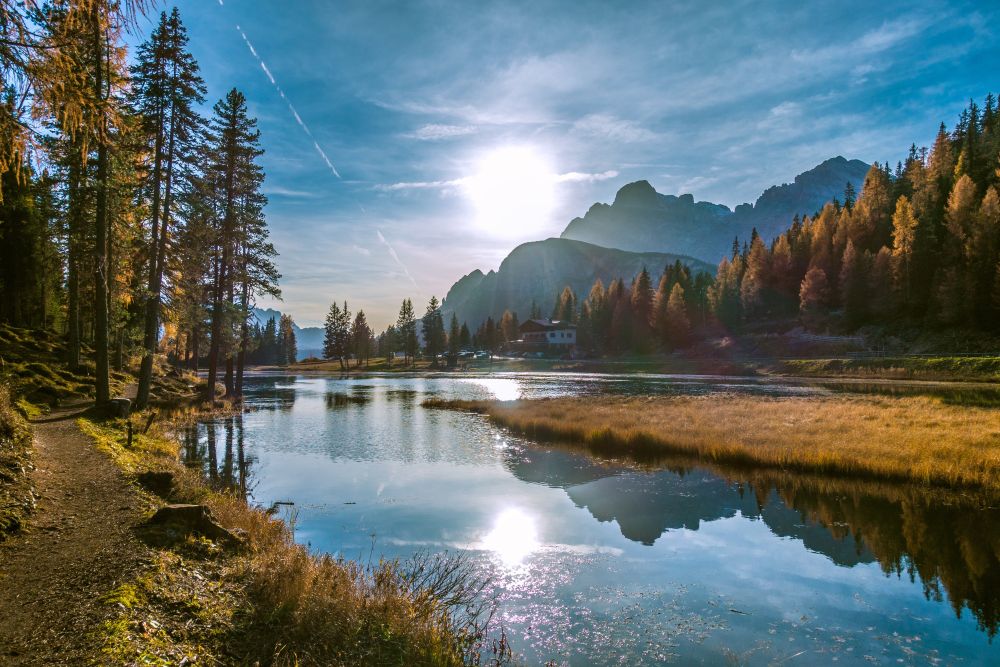
This is a circular hike starting from Lago Antorno, Auronzo di Cadore, Province of Belluno in Veneto (the Dolomites, Italy).
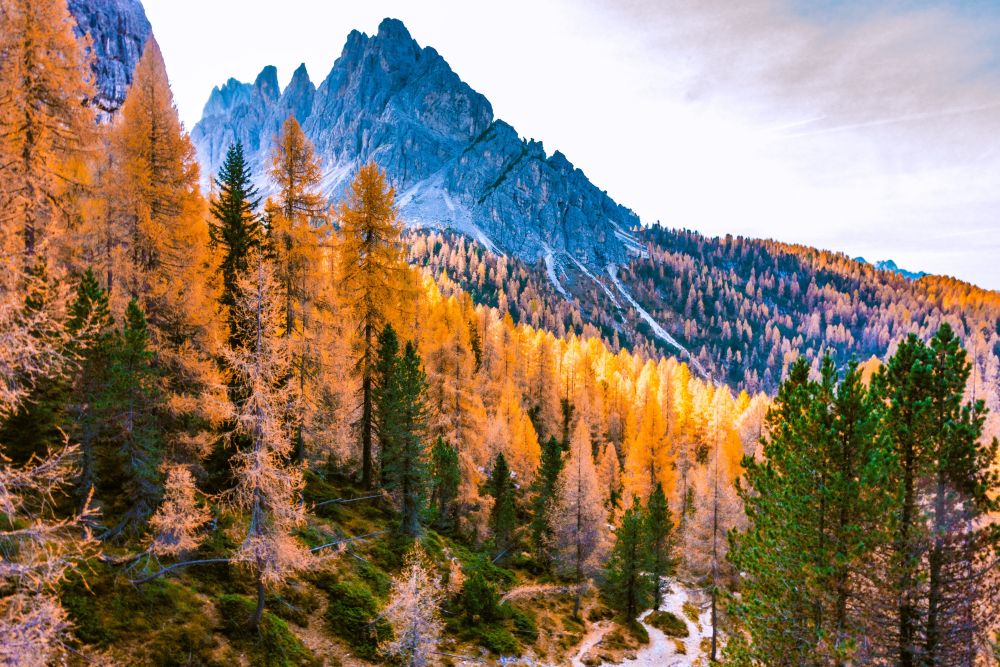
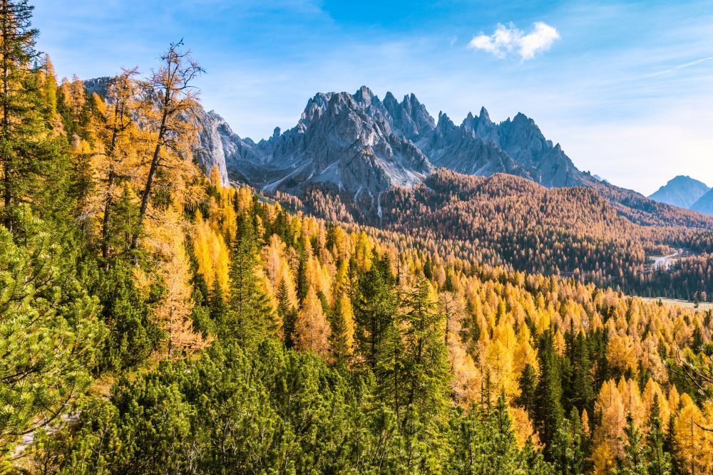
Top tip! Mid to late October is the best time for this hike. There are fewer crowds and the larch trees are stunning!
Tags: Circular hike, Food en-route, Accommodation en-route, Views of mountain lakes, Ice-cream at end of hike, Can be shortened
Rating: ![]()
Hiked by us on: 25th October 2019
This is a very wonderful hike that encircles the Tre Cime completely, starts at a beautiful lake, passes several huts on the way and has great views all around. There may be crowds on the top, so avoid the main holiday season. But there are also quiet sections and views that will more than make up that.
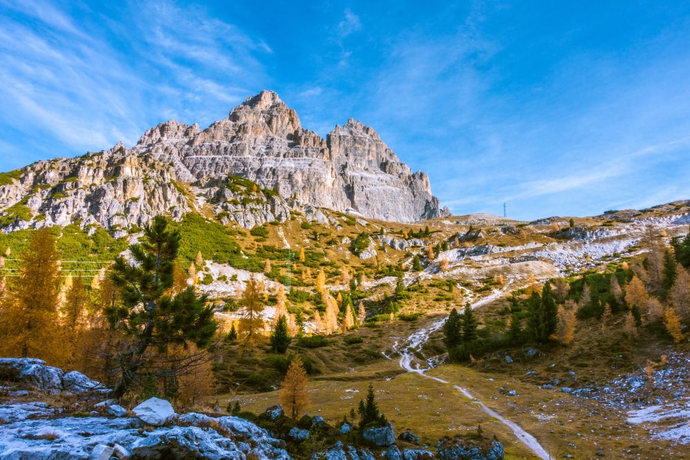
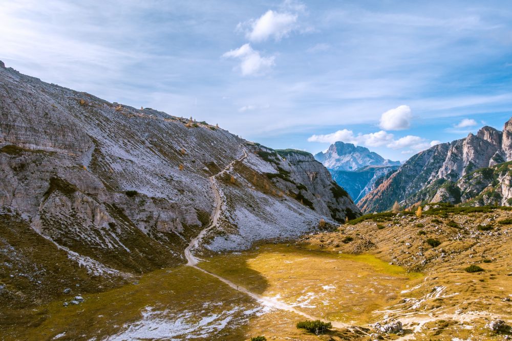
Start at the beautiful Lago Antorno, where there is plenty of parking. Walk along the lake to find a small path leading off the road into the woods. Follow this path until you reach the toll station. Now the path turns off to the right, leading through woods and sunny meadows.
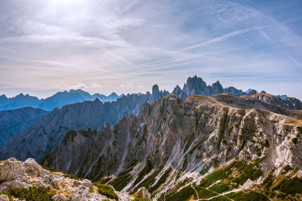
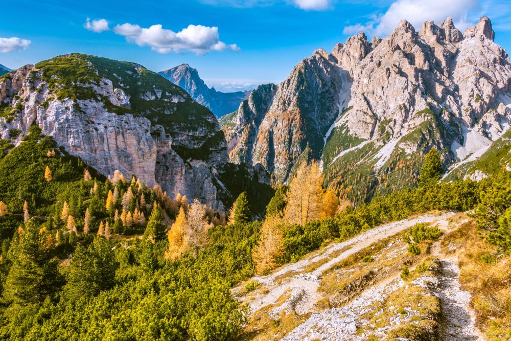
The views are getting better as the path is meandering uphill. After a short while the rocks of the Tre Cime is visible through ahead, though it is not yet the iconic view one might know from pictures.
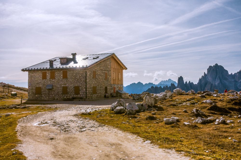
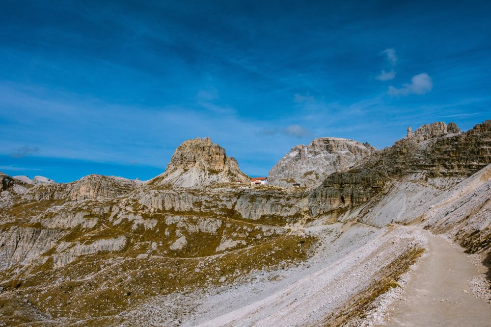
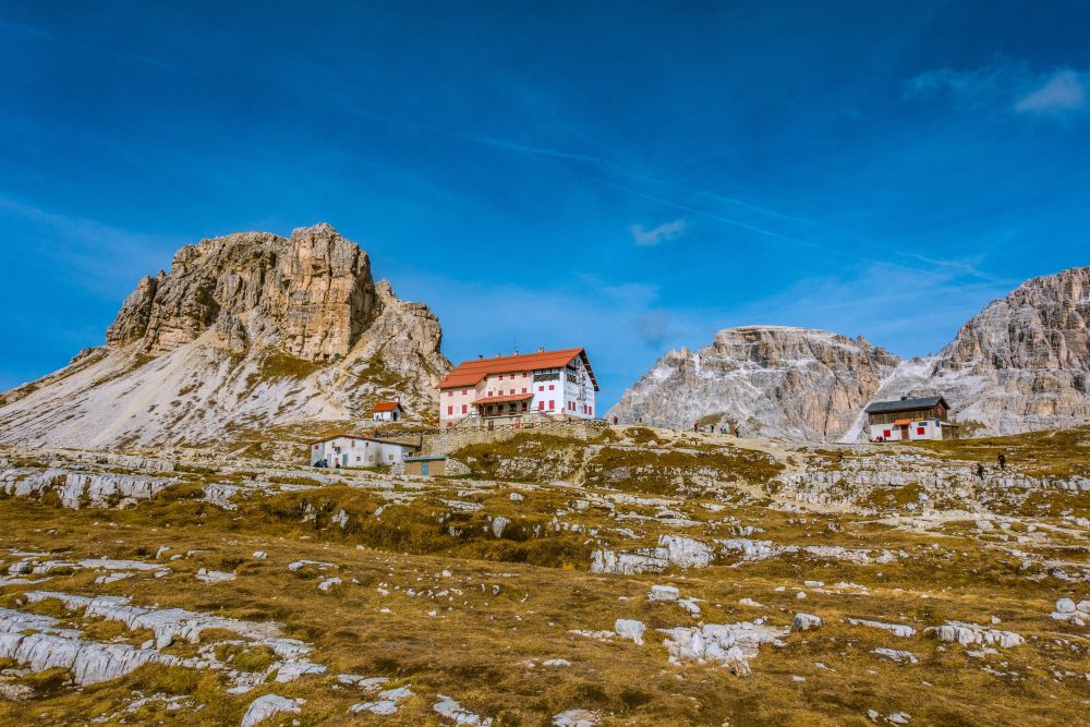
Soon you will see the Rifugio Auronzo up ahead, just underneath the rock formation. Below the last steeper slope you will get to a junction. Either path leads up to the hut, but the left stays close to the road while the one on the right leads through quieter meadows. Turn right and make your way up to the ridge below the hut. Once you reach the ridge, more wonderful views will open up.
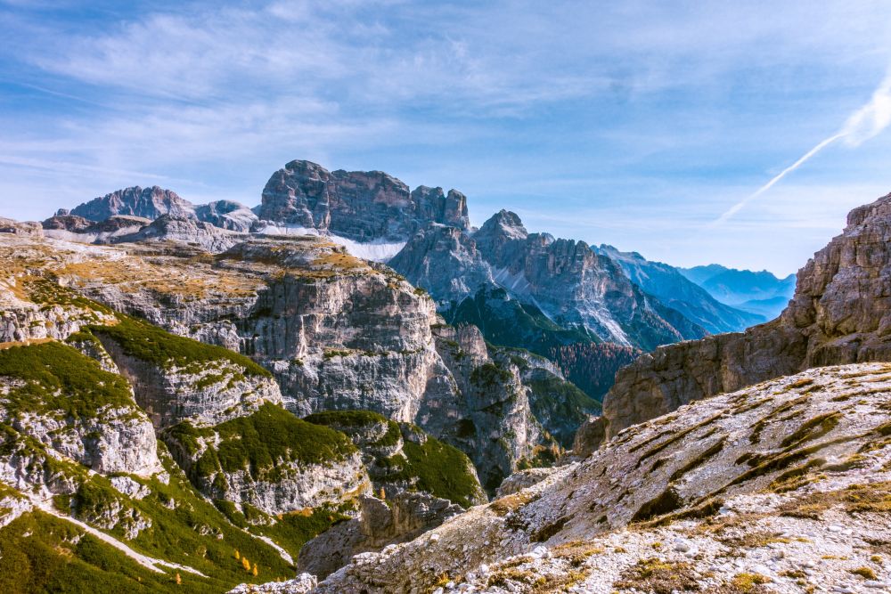
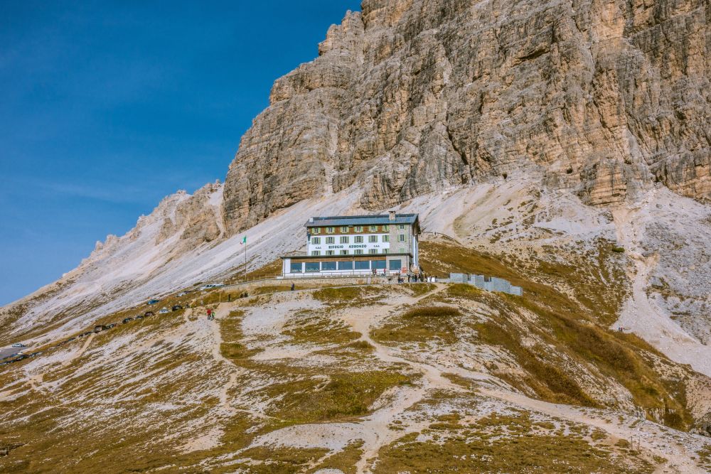
On the ridge turn right and make your way up to the Rifugio Auronzo. There is a large parking lot next to the hut and there will be crowds along here, so best move on quickly. A path turns right underneath the Tre Cime rocks, leading along the slope and offering stunning views across the surrounding mountains.
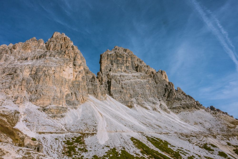
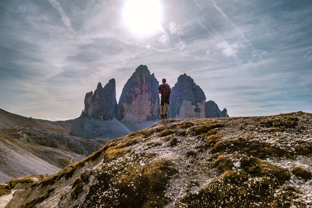
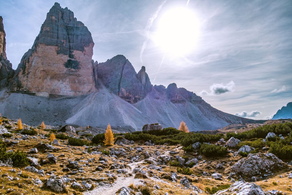
The path is wide and easy to walk, so perfect for having a look around. Soon you will reach the Rifugio Lavaredo and afterwards the path turns uphill again. After a short steep section you will reach the Forcella Lavaredo mountain pass. Here you are very close to the actual rocks and some people actually climb up to touch them.
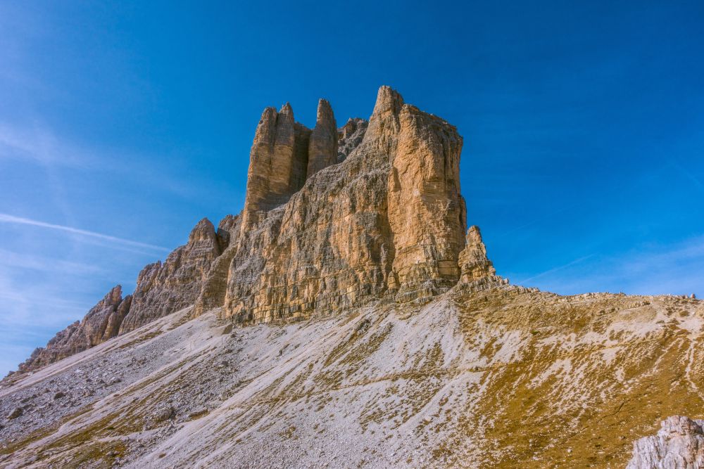
From the pass two paths lead to the Drei Zinnen Hütte, the hut with a great view of the Tre Cime. Take the lower path as it is wide and even and allows looking around. The higher path is of course also possible but in some places a bit narrow and exposed.
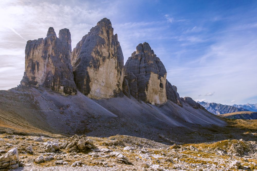
The Tre Cime hut is closed in autumn but is still worth a visit. From here you really have the very best view of the icon Tre Cime. There are benches outside, so have a sit and enjoy the view.
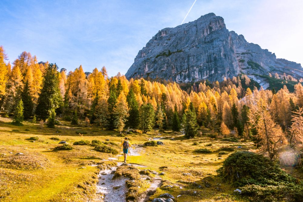
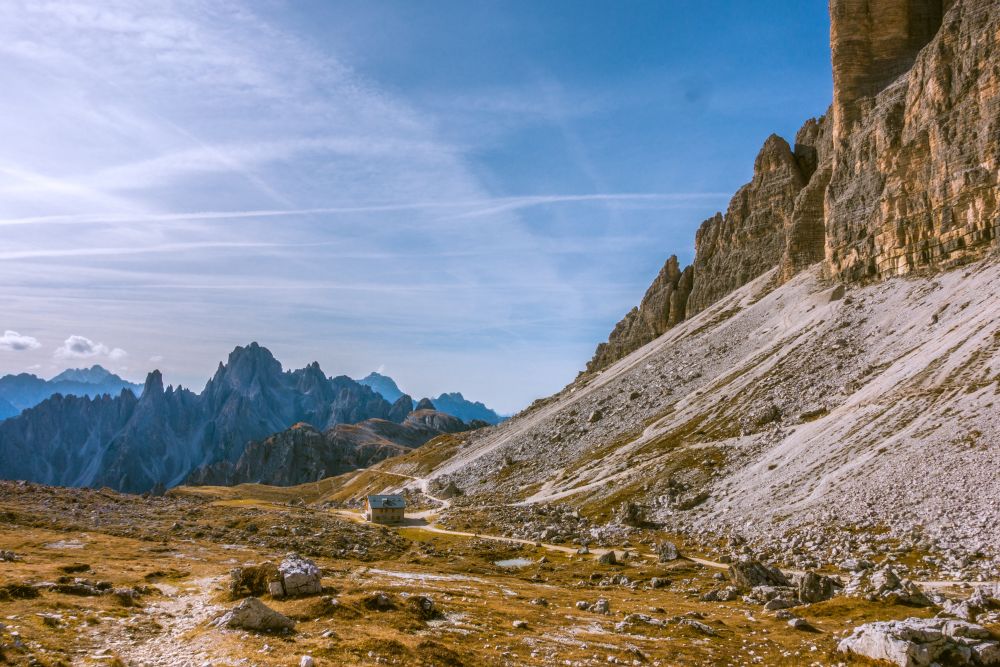
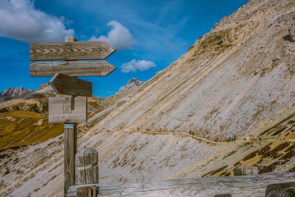
When you are ready to continue, go back to the junction just underneath the hut and turn onto the path that leads down into the valley below the Tre Cime rocks. Follow path 105 towards Lange Alm.

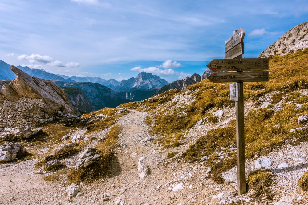
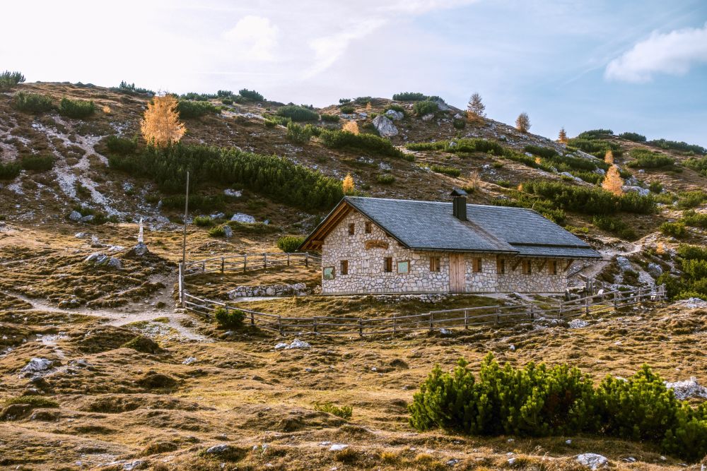
The path leads downhill for a short section and then uphill again towards a high plateau towards the west side of the Tre Cime. Now the path leads through the rocky plateau, only gently uphill, until you reach the Langalm hut.
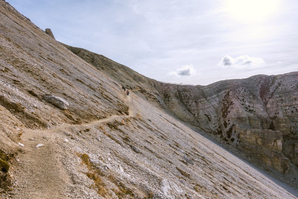
After the hut you will have to conquer the last uphill, though it’s not long and soon you will reach the pass on the west end of the Tre Cime. Now it’s even through a scree slope until you reach the Forcella del Col deMedo.
At this pass the crowds will turn left to get back to the parking lot. Here is your chance to get some quiet time. Turn right and follow the path along the grassy ridge. Again the views are stunning and already it is much more quiet.
Soon the path leads into the woods and starts winding down in serpentines until you reach another junction. Turn left and continue downhill into the valley. It’s a gentle downhill all the way now and the views are simply stunning.
Once you reach the valley, you will arrive at a road. Turn right onto the road and follow it for a few meters, then the path turns off to the right again, leading through a small valley until it gets back onto the road when you arrive back at the toll station. Cross the road and find the path again that you used in the morning. Follow it back to the Lago de Antorno. Arriving at the lake it is well worth walking around it to the right. There is also a restaurant at the end of the lake that invites for a refreshing drink to finish this stunning day.
Food, accommodation and/or villages we found on this hike
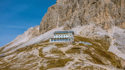
Rifugio Auronzo
(Food and accommodation)
The Alpine hut “Auronzo” is at 2,333 m and you can reach it on foot or driving up the quite large scenic route in a majestic landscape overlooked by the three needles which are a practice wall uniting the earth with the sky.
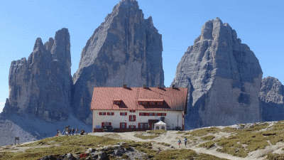
Drei Zinnen Hütte
(Food and accommodation)
One of the most famous huts in the Dolomites - be sure to book accomodation early.
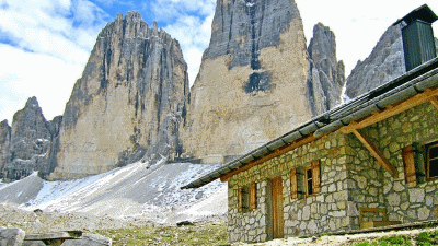
Langalm Hut
(Food only)
The Langalm hut is only open in summer. Usually from the beginning / middle of June to the end of September (depending on the weather). Visit this website and you will find the latest data. Hopefully see you soon this summer ...
The 5 day forecast in Cortina d’Ampezzo
Webcams
We could not find any webcams in the area close to this hike.
Need some hiking down-time?
If you need a day off from hiking, below are some of the great things you can do within 30 km from the start of this hike.
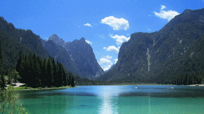
Toblacher See
(12.5 km away)
A beautiful alpine lake for wandering, boating or swimming.
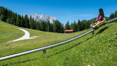
Fun Bob Auronzo
(12.6 km away)
Summer sledging in the Dolomites!
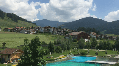
Toblach natural outdoor pool
(15.3 km away)
Surrounded by greenery, with a unique view of the mountains of the Höhlensteintal, you can relax and unwind at the natural bathing lake in Toblach
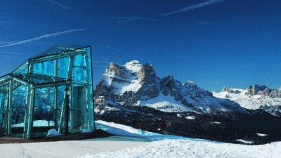
Messner Mountain Museum (Dolomites)
(23.4 km away)
Rheinhold Messner mountain museum - this one based on the mountain peoples
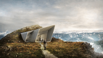
Messner Mountain Museum (Corones)
(28.6 km away)
Rheinhold Messner mountain museum - this one based on traditional alpinism
Rate this hike
Have you down this hike? What did you think? Please leave us a rating!
Thanks for your rating!
Leave us a comment - thanks!
Interested in this hike?
Please feel free to contact us for more information.