
Tre Croci – Lago Sorapis – Forcolla Marcuoira – Tre Croci

A visit to the stunning, turquoise Lago Sorapis
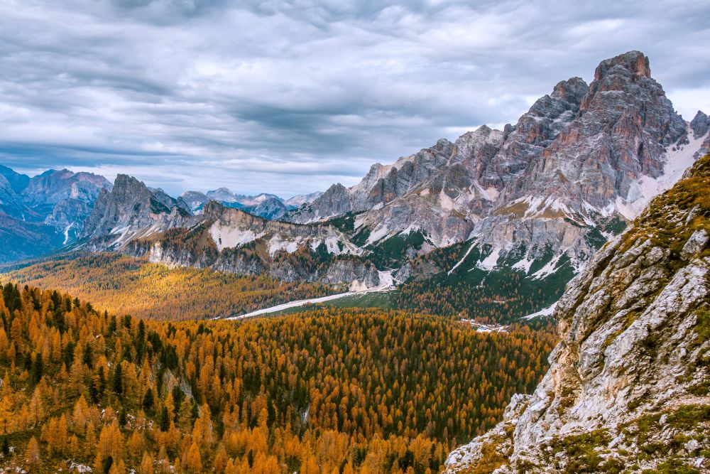
A glorious hike deep in the Sorapis range of mountains to the beautifully turquoise Lago Sorapis. It is then followed by amazing views from the Forcolla Marcuoira before a final stroll through extremely pretty larch woods.
This is a circular hike starting from Passo Tre Croci, Cortina d'Ampezzo, Province of Belluno in Veneto (the Dolomites, Italy).
Top tip! The lake can be extremely busy in mid-summer, so maybe avoid this time of year!
Tags: Circular hike, Food en-route, Accommodation en-route, Views of mountain lakes
Rating: ![]()
Hiked by us on: 24th October 2019
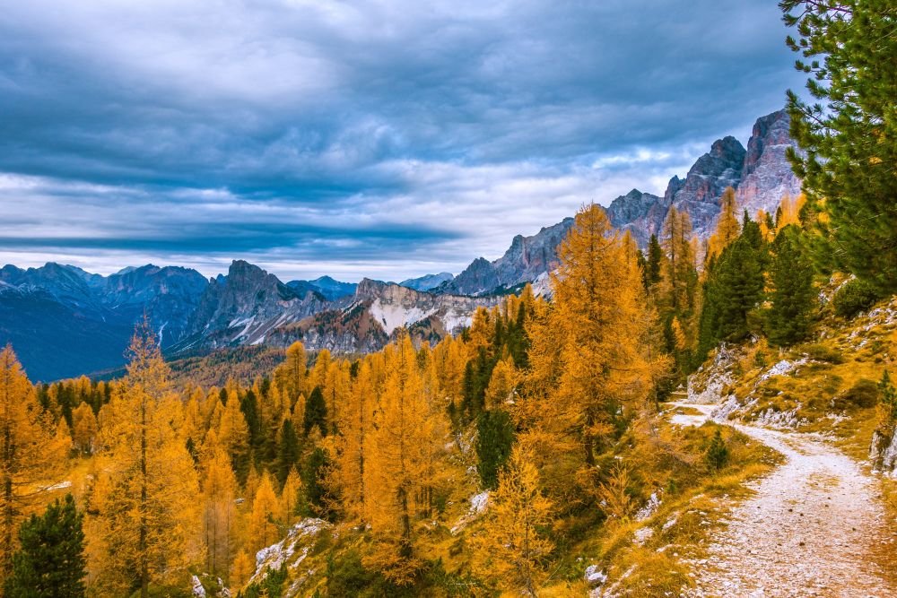
This hike is an adventure but can be shortened into an easier hike. It leads to the beautifully turquoise Lago Sorapis, across a few passes and along some stunning views of the Dolomites. To get the larch trees at their most beautiful, go in late October, though the lake might be at it’s best in summer.
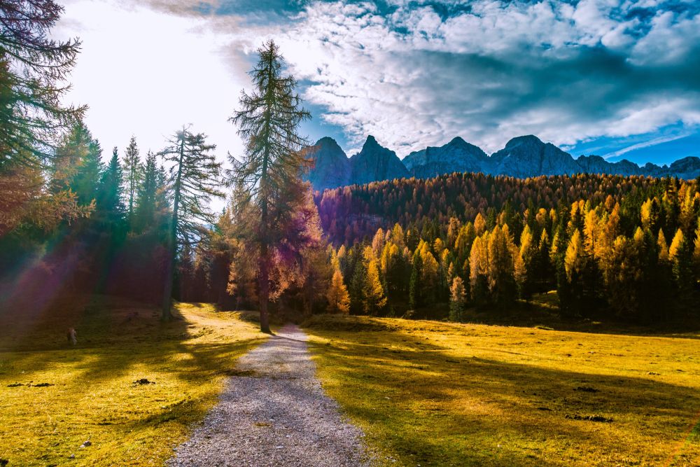
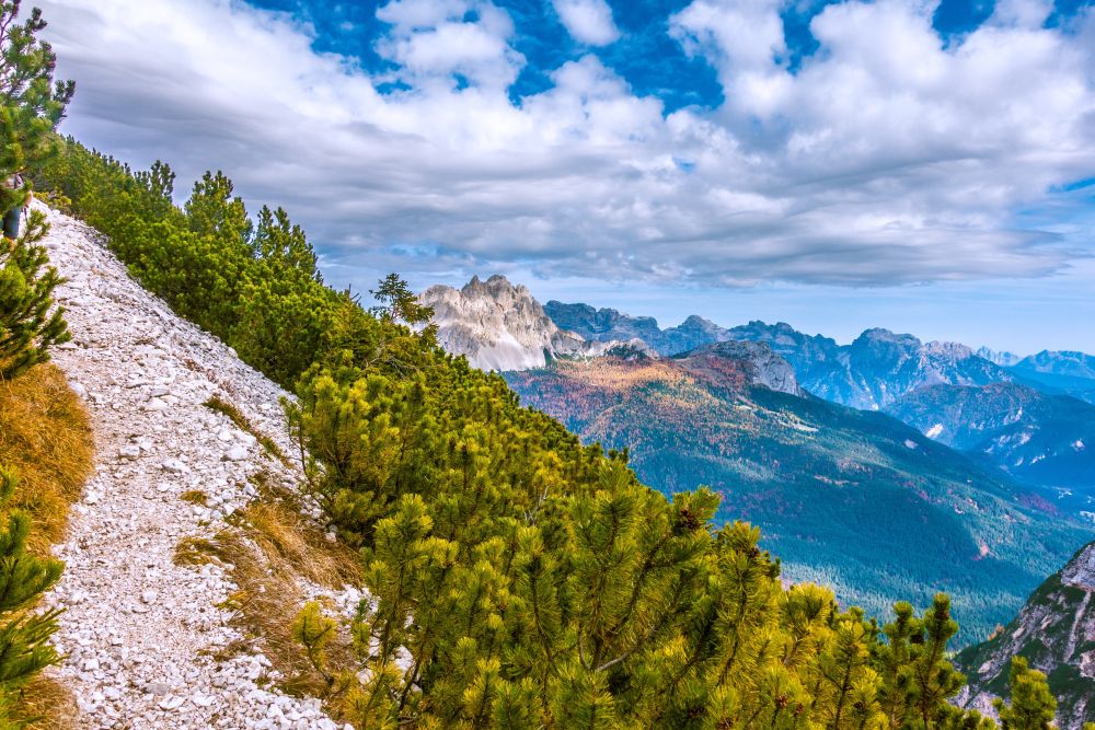
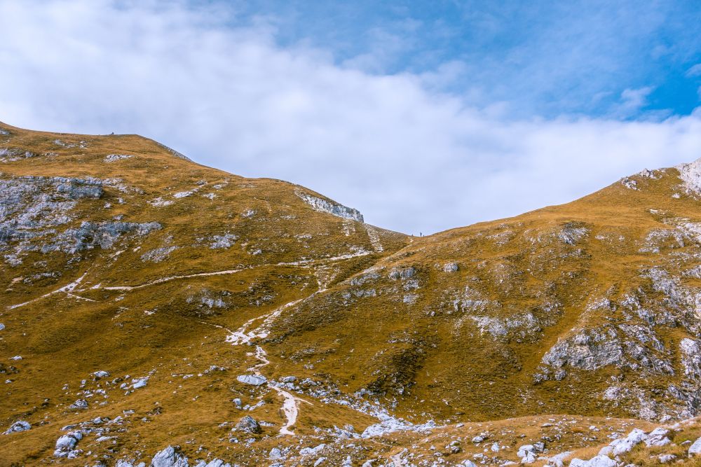
The hike starts only a stones throw from Cortina d’Ampezzo at the Tre Croci. There is an old hotel and parking along the road. Begin the hike on path 215 by crossing the pastures with grazing horses. There is a wide path leading into the woods. Plenty more horses to pass until the path starts getting narrower and turns into a mountain path.
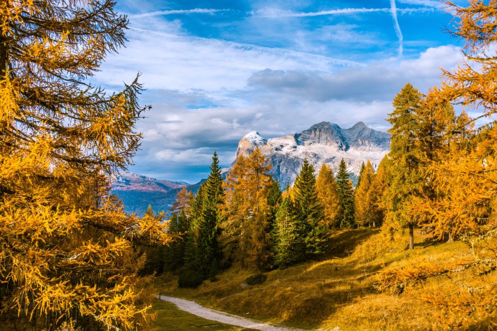
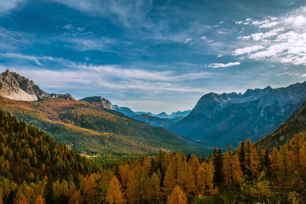
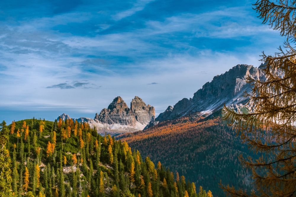
The path leads around the Sorapis group of mountains, slowly gaining height. It sometimes has to navigate small landslides, but it’s an easy mountain path all the way to the lake. Views along the way, for instance of the Tre Cime, are stunning.
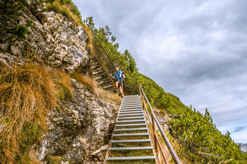
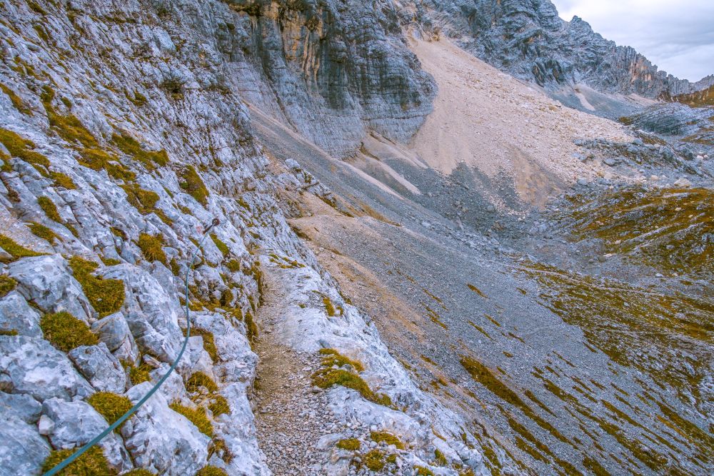
If you study the Tabacco map before starting the hike, you may notice a few “+++” marks along path 215. They usually mark tricky sections along the route. In case of this route, there is first a set of ladders to walk up, which are really stairs rather than ladders. Then there is a short section, where the path leads along a steep drop on one side but is secured with a rope on the other. If you do not mind heights too much, this should all not be a challenge.
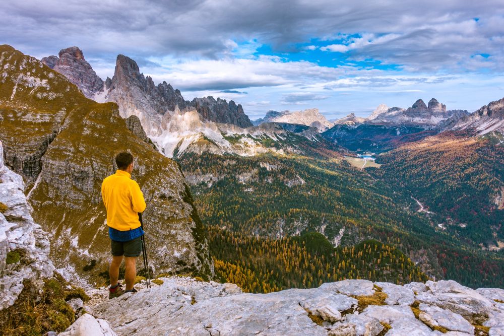
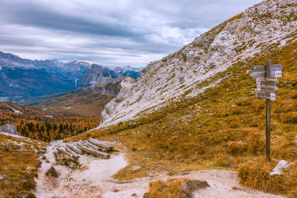
Soon after passing the narrow section, you will notice the Refugio Vandelli ahead. Once you reach the hut, you are very close to the lake. It is worth making the little detour to the hut, even when it’s closed, as the views are beautiful. After visiting the hut, make your way to Lago Sorapis, just around the corner.
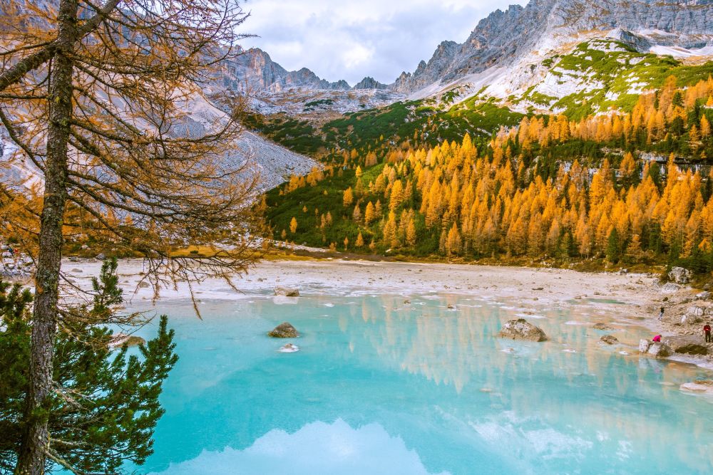
There is a path leading around the lake, but it involves a bit of scrambling. The stunning color of the lake, certainly invites to spend some time here. However, once you are ready to move on, back trace your steps along path 215 until a junction where path 216. Now it’s decision time. You could return to the start of the hike along the way you came, however, if you don’t mind a steep uphill and would like a bit more adventure and a lot more views, turn onto path 216.
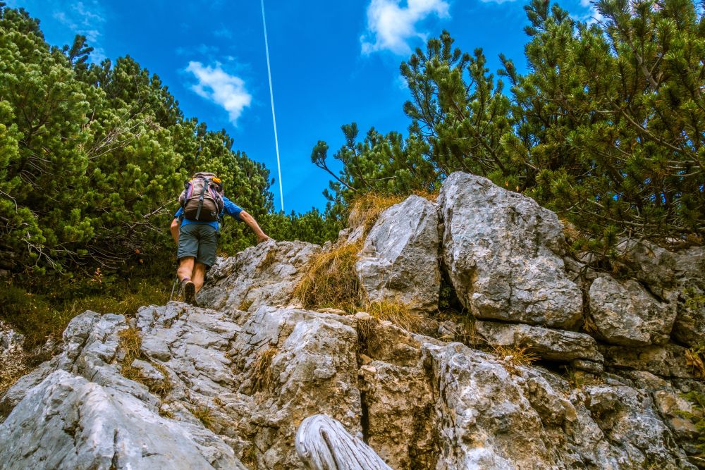
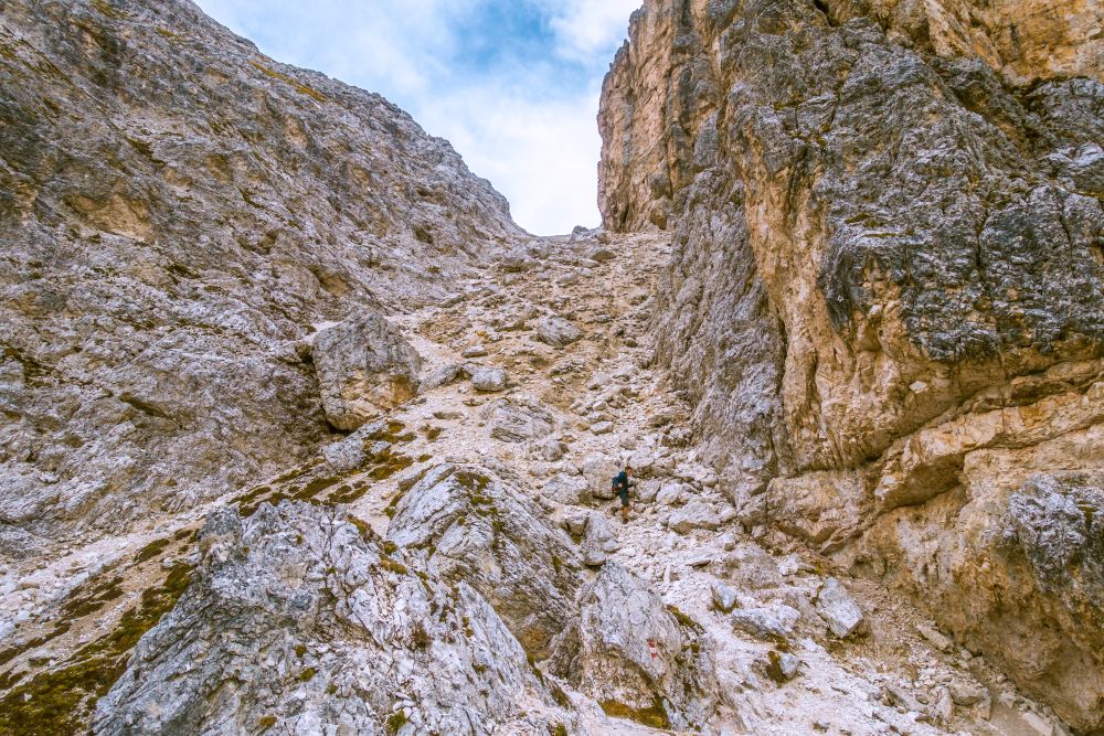
The path now starts leading uphill steeply for 400 height meters. There are a few sections of scrambling involved, where you may need to use your hands. And just before you reach the next pass, the gravel path gets really quite steep to walk up.
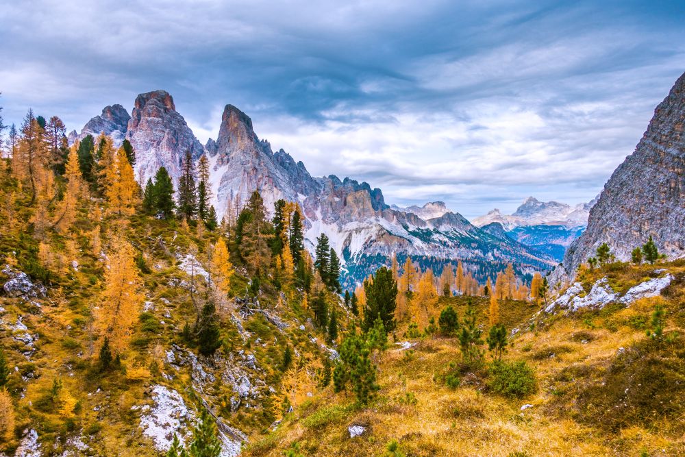
And then you stand on the pass and can enjoy the stunning views around. You have really done most of the hard work at this point, so it’s a great place to give yourself a break.
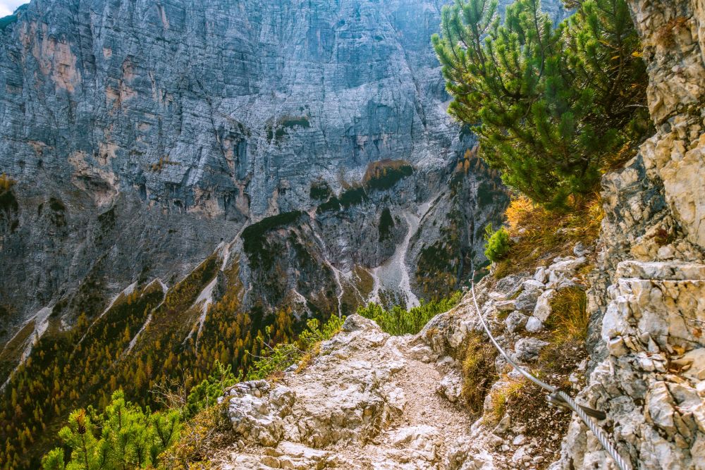
Moving on from this point, you will pass the next section marked with an +++ in the map. It’s a short section of path that is rather exposed on one side but secured with a rope. So if you have a head for heights, it should not be a problem at all.
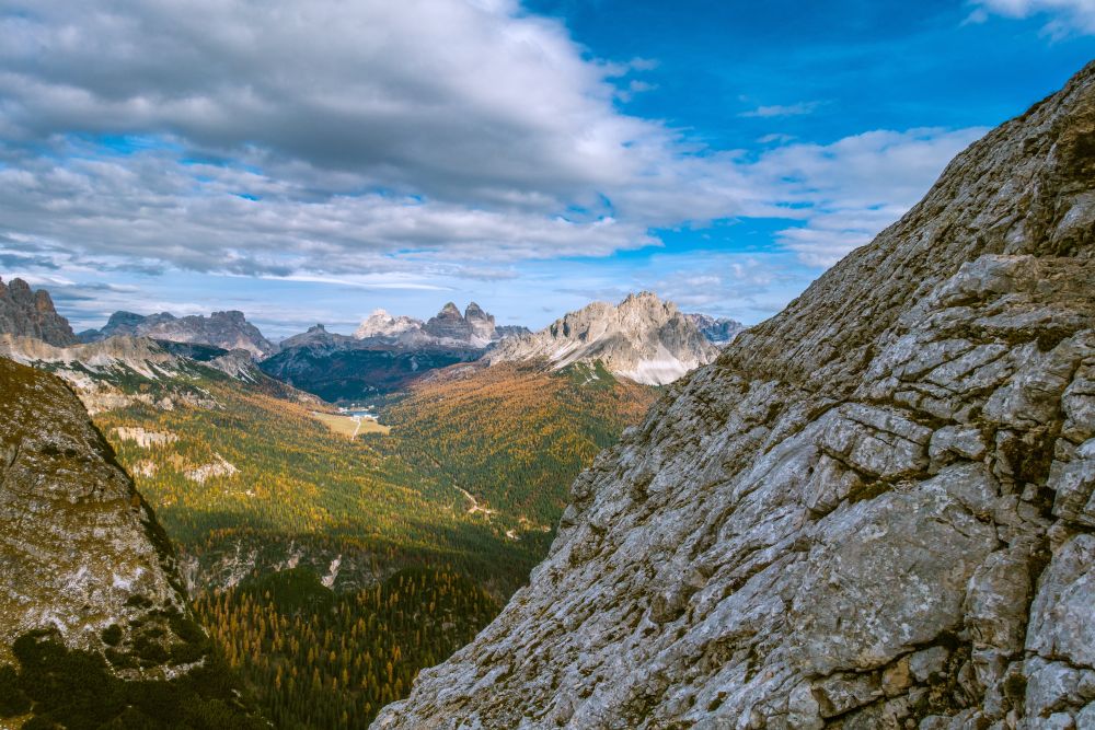
From the pass, there is now a short downhill section and then it’s the last uphill until you reach Forc. Marcuoira, the highest point of this hike.
From the pass down, the possibly most difficult section needs to be conquered. There is a steep slope to walk down, which almost entirely consists of loose rock. It is very slippery and unpleasant, so best pass it with care and make sure, not to kick any rocks onto hikers below. The views from the slope are great, so there is a good reason to stop occasionally and look around.
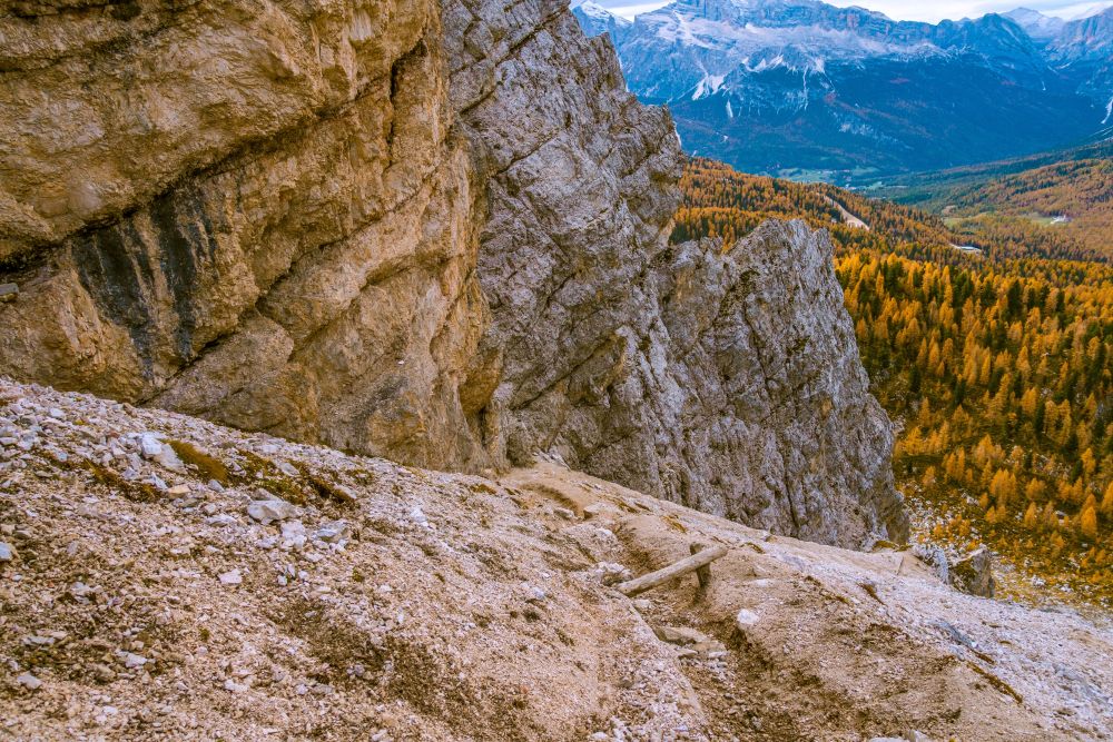
Once you reached the bottom of the slope, the path leads evenly along the slope, back into the trees. the views along here are beautiful and well worth having made the walk over the two passes.
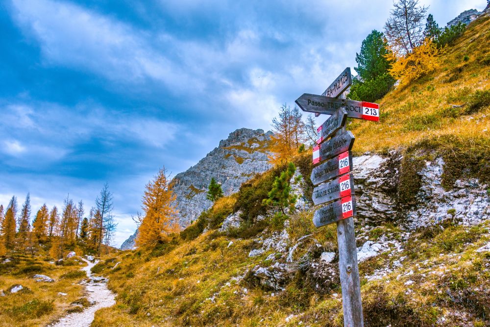
Soon you will reach a signposted junction, where you turn right onto path 213. Now it’s any easy way down along a wide path through the woods. It’s again lovely views along here and in autumn leads through orange colored larch trees. Soon you will be back at the start if the hike at Tre Croci.
Food, accommodation and/or villages we found on this hike
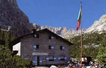
Refugio Vandelli
(Food and accommodation)
The Refuge is located at the center of the circus northern Sorapiss, almost to the edge of the base surface and where the waterfall plunges. A few minutes from the Refuge, separated by a short hill, there is the wonderful lake of turquoise color.
The 5 day forecast in Cortina d’Ampezzo
Webcams
We could not find any webcams in the area close to this hike.
Need some hiking down-time?
If you need a day off from hiking, below are some of the great things you can do within 30 km from the start of this hike.
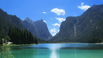
Toblacher See
(16.3 km away)
A beautiful alpine lake for wandering, boating or swimming.
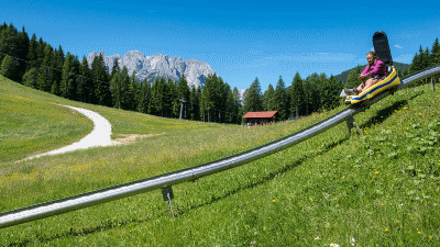
Fun Bob Auronzo
(16.7 km away)
Summer sledging in the Dolomites!
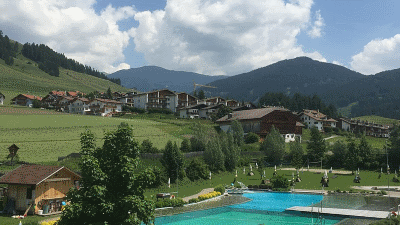
Toblach natural outdoor pool
(19.2 km away)
Surrounded by greenery, with a unique view of the mountains of the Höhlensteintal, you can relax and unwind at the natural bathing lake in Toblach
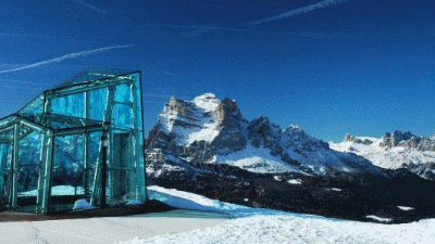
Messner Mountain Museum (Dolomites)
(19.6 km away)
Rheinhold Messner mountain museum - this one based on the mountain peoples
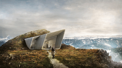
Messner Mountain Museum (Corones)
(27.7 km away)
Rheinhold Messner mountain museum - this one based on traditional alpinism
Rate this hike
Have you down this hike? What did you think? Please leave us a rating!
Thanks for your rating!
Leave us a comment - thanks!
Interested in this hike?
Please feel free to contact us for more information.