Walenstadt – Lüsis – Obersäss – Walendstadtberg

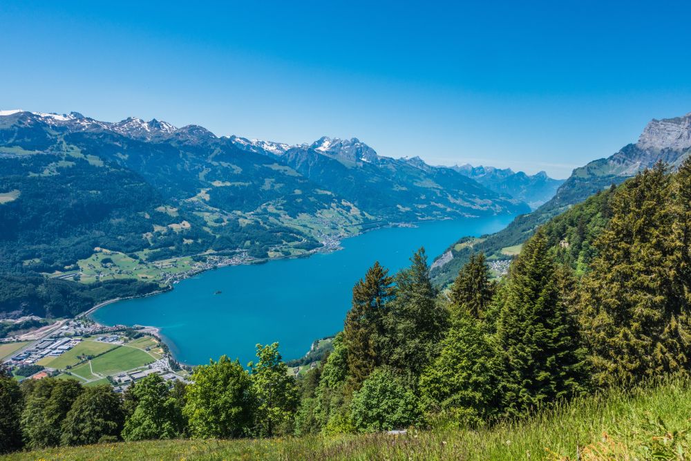
Flower filled meadows high above the stunning Walensee
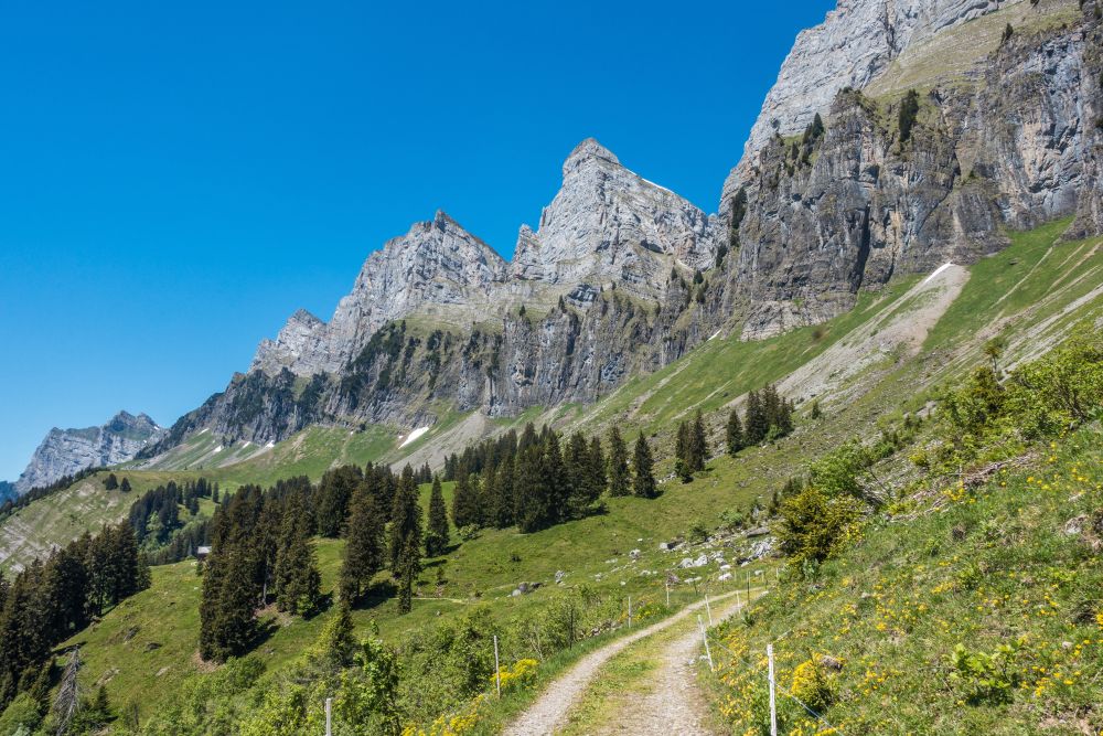
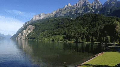
This stunning panoramic hike will lead you between the steep rock walls of the Churfirsten towering above you and the beautiful lake Walensee below.
This is a circular hike starting from Walenstadt in St Gallen (north-east Switzerland).
Top tip! End of May early June is the best time for this hike - the spring flowers are gorgeous. Warning - don't do this hike if there is still snow on the upper levels - there are steep slopes to cross and it can be dangerous with snow.
Time of year: Spring, Summer, Autumn
Tags: Circular hike, Public transport, Food en-route, Views of mountain lakes, Cute villages, Ice-cream at end of hike, Can be shortened
Rating: ![]()
Hiked by us on: 31st May 2020
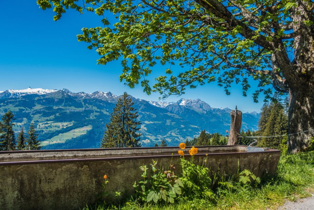
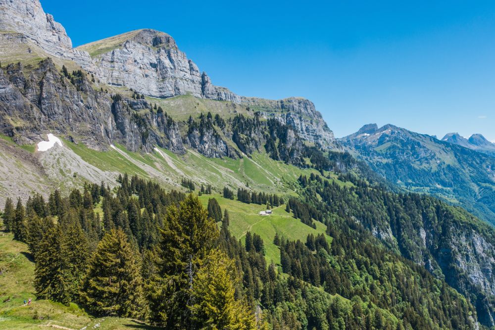
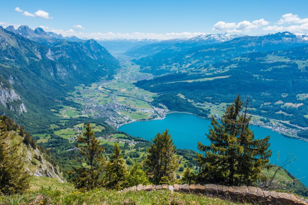
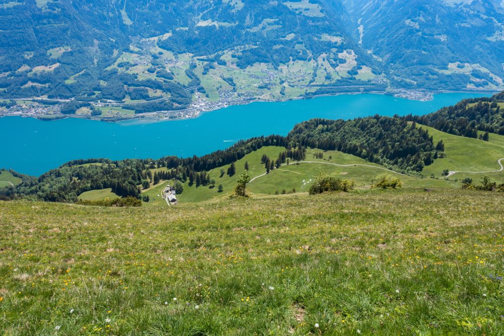
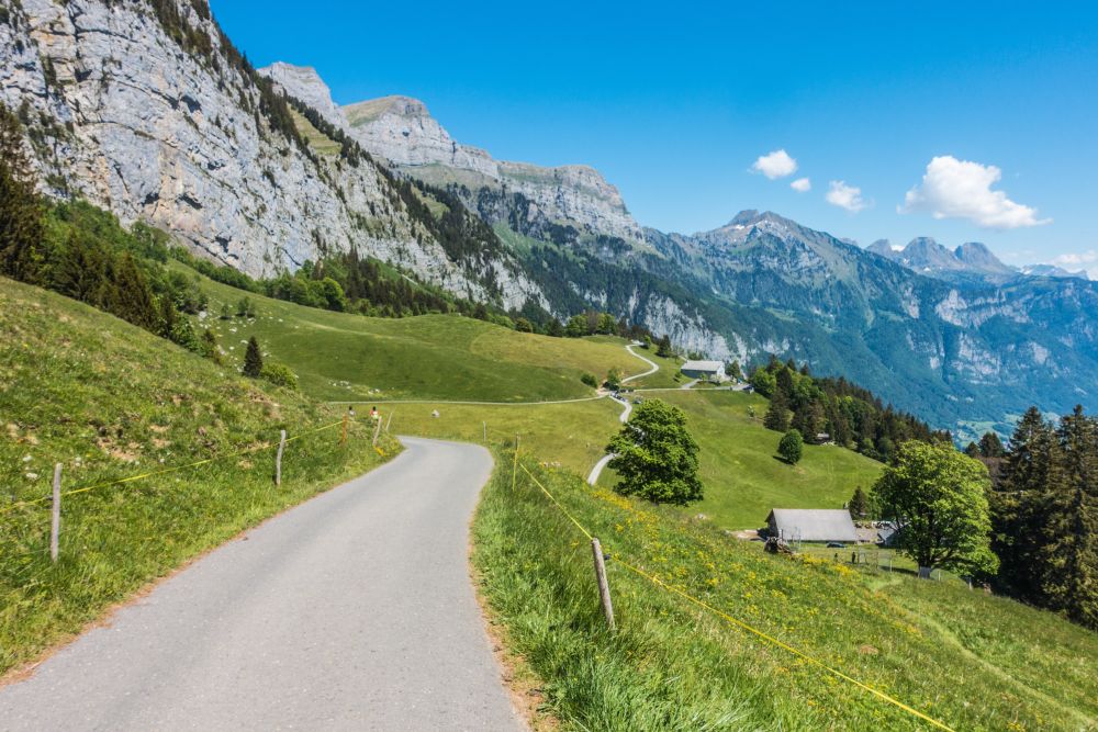
This beautiful panoramic hike is perfectly framed by the steep rock walls of the Churfirsten above and lake Walensee below. It does take some stamina to get all the way up to the high path, but once done, the amazing views will sure make up for all the hard work.
Start in Walenstadt, where there is a large parking area directly by the train station. Walk through the village towards the large south facing wall towering above it. Once you get to the end of main street, turn right and left again after a stream. Walk along the stream, following the signs to Lüsis. The path keeps following the stream gently uphill for a while until it turns off to the right, now leading along the edge of the woods. There is a bench along here for a first break and also a first glimpse of lake Walensee.
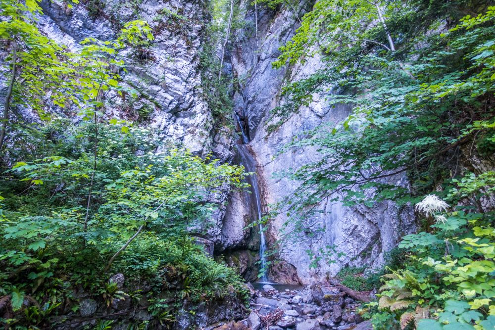
The path now leads into the woods and eventually comes out onto a bend in a small road, on which you turn left. The road will lead along the slope almost evenly, until you reach a sharp left turn. Here the path turns off the road to the right. You may have to look out, as the path can be a bit hidden. Follow it along the slope and watch your step. The track becomes rather narrow along here and the slopes are steep in places. Soon you will reach a lovely waterfall in the woods.
Cross the stream and continue towards Lüsis. The path soon starts getting steeper and now the hard work starts. There are numerous serpentines leading uphill through the woods. And while the trees may prevent the views opening up just yet, you will be glad for the cooling shade during the summer months.
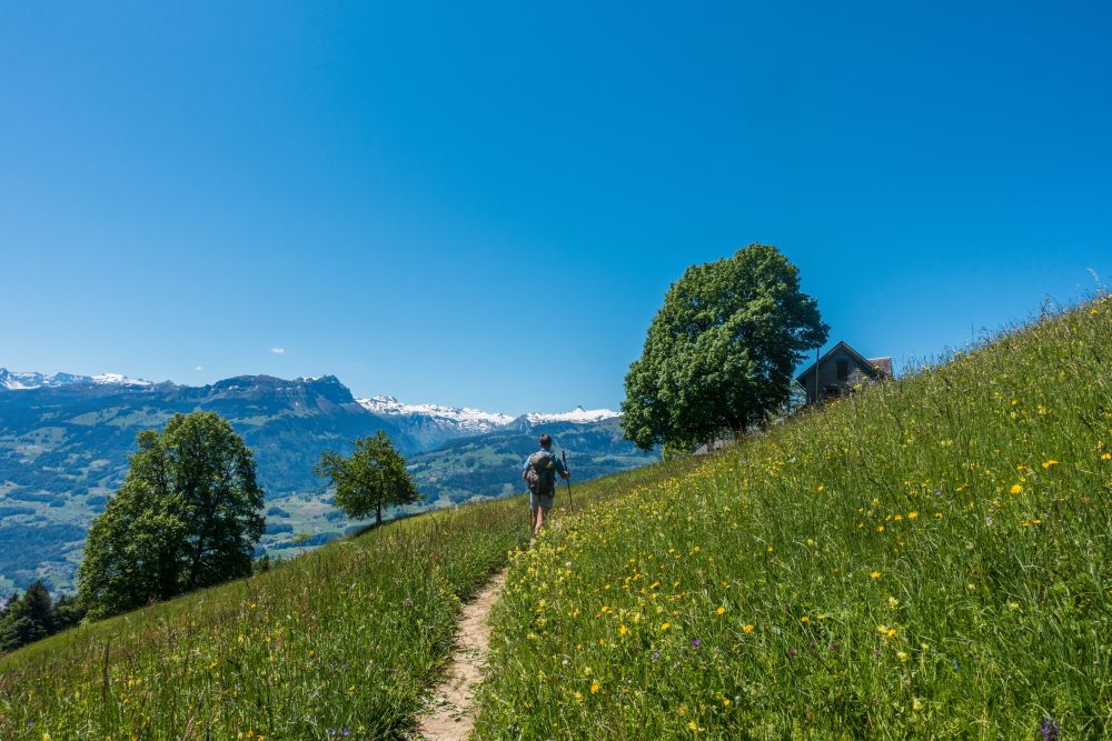
And then you finally reach a level gravel road on which you turn right. After a few meters, there is a path to the left directly to Lüsis. Do not take this path. Instead continue straight along the gravel road and soon you will step out of the woods into flower filled meadows. The the first houses come into view and there is a bit more uphill to do, but soon the walking gets a lot easier. Views of lake Walensee open up and you will find the occasional bench to enjoy them from.
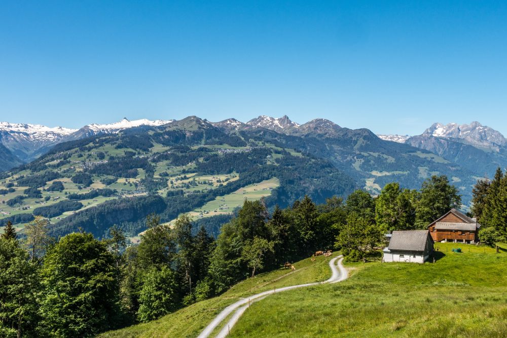
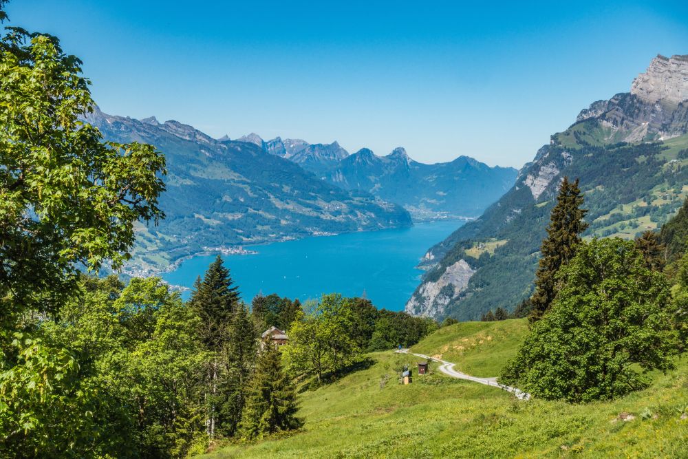
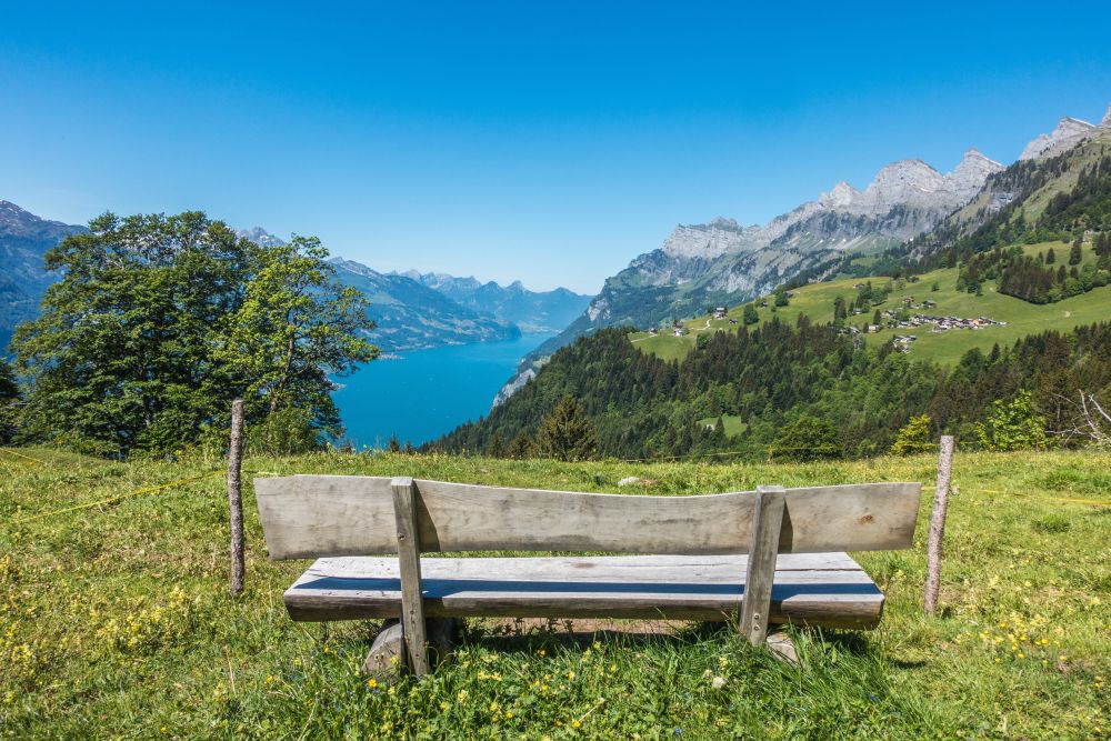
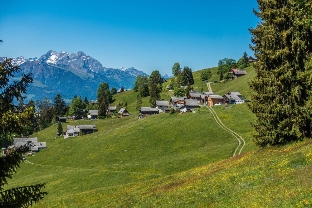
Once the path levels off, you have reached the high path. Now you can enjoy the most beautiful part of this walk with amazing views all along. You can see the impressive Churfirsten above to your right, lake Walensee below and the Flumserberg mountains on the other side of the valley. Make your way through the flower filled fields and along the slopes of the Churfisten. Soon you will reach the little hamlet of Lüsis, with it’s lovely wooden houses.

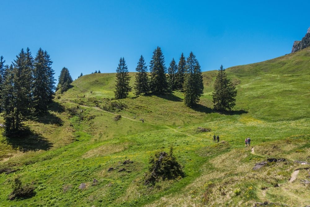
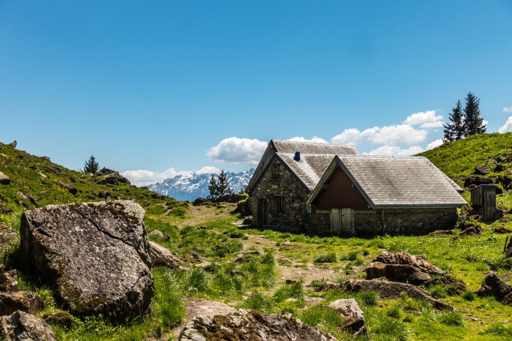
Pass through the houses and through the fields on the other side. The path continues along the slopes, leading only gently uphill. There is plenty of time now to marvel at the abundance of flowers and views all around until you get to the Alp Tschingla hut.
At Alp Tschingla, a steep path comes up from Walenstadtberg, so it can be a bit busy here. Especially since there is food and drink and a viewpoint at the hut, all inviting hikers for a break. From the Alp, turn left into a small path that continues evenly along the slope, before it turns into a steeper uphill. Once on top of this slope, you will look along a small valley that leads up to the high point of this hike. There are a few rocks to negotiate and a few more height meters to conquer and then you are done with the uphill for the day.
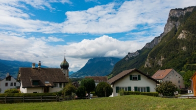
Now it’s past the Obersäss huts and then steeply downhill through the fields until you reach the small road. Turn left along the road. There is another restaurant, Alp Schrina, a bit off the path to your right. But the hike continues along the road all the way into Walenstadtberg.
From Walenstadtberg you can take the bus back into Walenstadt if you are lucky. However, the bus only runs every hour on the weekend and every two hours during the week. If you don’t want to wait, you can also walk down into Walenstadt, following the hiking signs.
Food, accommodation and/or villages we found on this hike
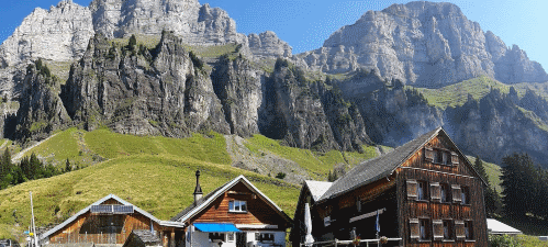
Alp Tschingla
(Food only)
The Alp Tschingla is a Mutterkuhalp with an Alpbeizli at 1528m above sea level, in the middle of the Churfirsten. Around 80 cattle spend the summer here. The Beizli has a garden restaurant with a wonderful panoramic view of Graubünden, Sarganserland and Walensee area all the way to Glarnerland. There is a playground for our little guests.
The 5 day forecast in Walenstadt
Webcams
We could not find any webcams in the area close to this hike.
Need some hiking down-time?
If you need a day off from hiking, below are some of the great things you can do within 30 km from the start of this hike.
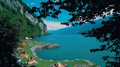
Walenstadt lakeside beach
(1.1 km away)
Large grassy swimming area with wonderful views of the surrounding mountains
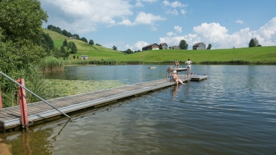
Badi Schönenbodensee, Wildhaus
(10.5 km away)
Beautiful small lake for swimming above Wildhaus below the Alpstein
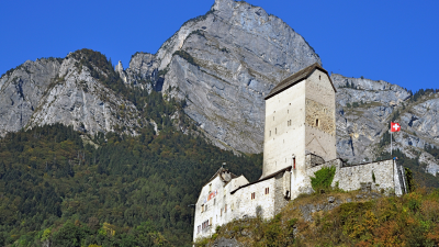
Sargans castle
(12.1 km away)
900 year old castle full of history (and a restaurant)
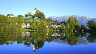
Werdenberg
(12.3 km away)
800 years of history and the smallest city in Switzerland - beautifully preserved places to visit
Lago Mio
(14.7 km away)
Lovely little swimming area on the banks of the Walensee close to Weesen
Flaesch village
(18.4 km away)
A beautiful small village renowned for its wine growing and opportunities to buy local wine.

Tamina thermal baths
(19.6 km away)
Exclusive wellness center, treat yourself!
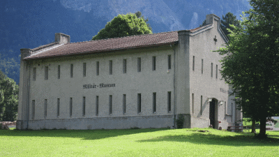
St Luzisteig military museum
(20.2 km away)
The eventful history and history of Luzisteig dates back to the 15th century.
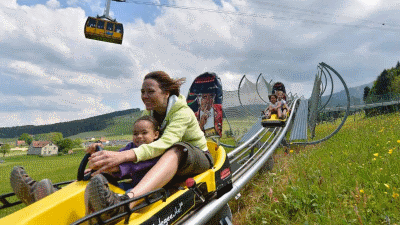
Kronberg Alpine park
(22.3 km away)
Alpine "park" with summer sledge run and rope park - fun for all!
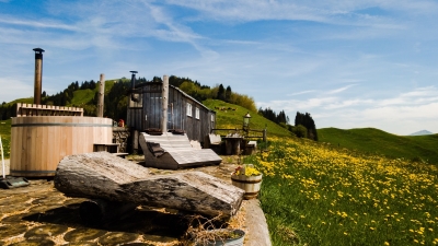
Hot-pot Appenzellerland
(23.8 km away)
Relax in a a unique hot-tub surrounded by Appenzeller hills and mountains
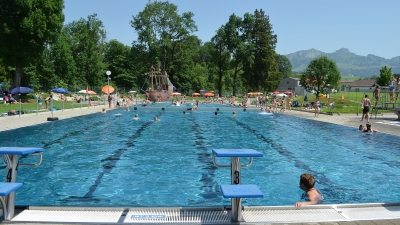
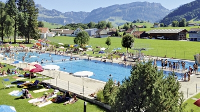
Appenzell outdoor pool
(24.3 km away)
Great outdoor pool in the shadow of the Alpstein mountain range
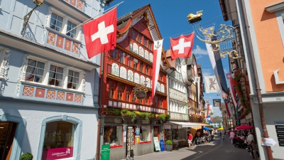
Appenzell town
(24.5 km away)
Wonderful historic picturesque town at the foot of the Alpstein mountain range
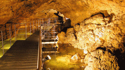
Kobelwald crystal caves
(28.0 km away)
Fascinating underground caves - worth a visit in any weather
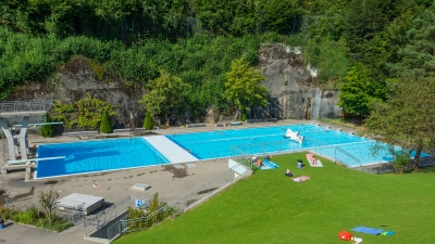
Lichtensteig outdoor pool
(28.3 km away)
Wonderful relaxing pool in the Toggenburg region
Gais outdoor pool
(29.6 km away)
Small quiet outdoor pool in Appenzellerland
Rate this hike
Have you down this hike? What did you think? Please leave us a rating!
Thanks for your rating!
Leave us a comment - thanks!
Interested in this hike?
Please feel free to contact us for more information.